You can download the latest updated database as an xls table.
You can also download a kml file for each area.
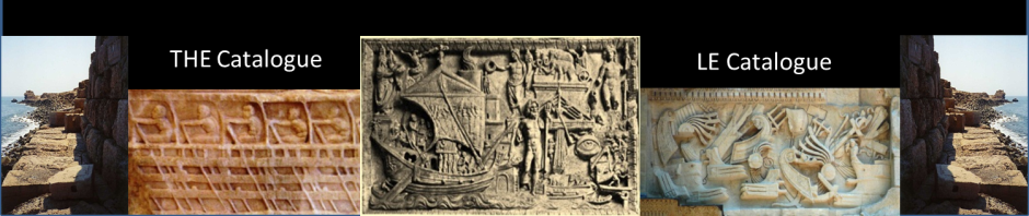
This Catalogue presents work done to collect, identify and locate ancient coastal settlements, harbours and ports.
It is based on a study of existing documentation.
The result is a list of nearly 6000 ancient ports
based on the writings of around 100 ancient authors
and hundreds of modern authors, incl. the Barrington Atlas.
The considered area spans from Iceland to Sri Lanka.
This list includes around
430 Neolithic places,
40 Etruscan ports,
130 Minoan ports,
200 Mycenaean ports,
360 Phoenician ports
and thousands of Egyptian, Greek,
Hellenistic, Roman and Byzantine ports.
Around 200 “potential ancient harbours”
from a nautical point of view,
have been added, based on nautical guides/pilots
used by modern sailors.
WHAT are we talking about?
A harbour is a place where ships can seek shelter. The concept of ‘shelter’ has to include i) anchorages, ii) landing places on beaches, and iii) ports with man-made facilities for landing passengers and goods, including structures such as access channels, breakwaters, jetties, landing stages, quays, warehouses for storing commodities and equipment, shipsheds and slipways. It will be seen in our chapter on port structures that only a few of the shelters listed in our catalogue qualify as “ports”. Shelters of interest for this catalogue include all places which may have been used by seafarers sailing over long distances. Villae maritimae are also of interest, but shelters the likes of local fishermen, who may have landed their boats on the beach in front of their homes, are of less interest. In another limitation, only maritime harbours and some river ports that could be reached by deep sea ships are considered.
Bronze Age peoples often chose a coastal hilltop for their settlement, obviously for defensive reasons, and their boats were left on the nearest beach or creek. Later, Phoenicians were very fond of places with twin-ports, like their hometown at Tyre, enabling them to shelter ships on both sides of their settlement. Even later, Romans favoured river outlets for easy access to fresh water and to inland navigation. Further recent information on the history of ancient ports can be found in Arnaud (2017) « Les infrastructures portuaires antiques », in Marriner et al. (2017) « Harbors and ports», and in Morhange et al. (2016) « The eco-history of ancient Mediterranean harbours ».
Homeric seafarers often used beaches to land their ships on, like Senegalese fishermen still do today, but this was not an easy task. A 20 m triaconter with 30 “strong” oarsmen could be hauled on the beach if the slope was mild enough, say no more than 1:10, or 10%, or 6° (the steepest man-made slipways had a slope of 1:6 acc. to Blackman, 2013). However, with increasing ship sizes (and weights), beaching became unpractical, if not unfeasible, and places for safe anchorage were sought (see Greg Votruba, 2017 [1]).
During Athenian military expeditions, 200 people had to be fed on board triremes. It was impossible for ship masters to fill their ships with tons of food. In the absence of ports, ship pilots had to find shelters where drinking water could be found, and river estuaries could provide both. The Stadiasmus (from an anonymous author) is an example of a collection of such knowledge and can be considered the ancestor of medieval portolans and modern nautical instructions.
Commercial ships also preferred sheltered creeks and river estuaries, possibly with some kind of jetty, as their ships were too heavy to be pulled on the beach (see Pascal Arnaud, 2015 [2]).
Seafarers obviously preferred shelters with clear landmarks on shore (such as a typical mountain) and many shelters were needed, as seafarers often followed the coast, using safe shelters to stop overnight and escape bad weather. Even though they could sail 50 to 100 nautical miles in a day (see Ancient Measures), it was important to know where they could find safe shelter within two to three hours of navigation, i.e. only approx. 10 miles (see Capt. Maurice Mattei, 2001 [3]). With the length of the Mediterranean coast being around 25 000 nautical miles (according to Wikipedia), as an order of magnitude, they would hence have required at least 2500 shelters around the Mediterranean Sea. The present work collects about 3500 ports and shelters around the Mediterranean Sea between Gibraltar and Tangier (excluding the Black and Red seas). This shows that we probably found a fair percentage of them.
Many of these sheltered creeks still exist today, but large changes have sometimes occurred:
- crustal movements which explain why some ancient ports are now submerged (Alexandria, Crete);
- a eustatic sea level rise of around 0.50 m over the past 2000 years which has sometimes completely changed the seascape (large deltas);
- seismic events inducing tsunamis which devastated adjacent coastal areas (Crete, Crane/Agrostoli);
- river estuaries usually tend to silt up, as rivers carry most of the materials that create beaches, and this explains why some ancient ports are now so far from the sea (Ephesus, Portus at Fiumicino) or have simply filled up with sand (Leptis Magna);
- in some large cities the ‘old port’ has been reclaimed to create a new waterfront area (Marseille, Beirut);
- beaches are subject to sedimentation and erosion by wave action, and the latter explains why some ancient ports were lost to the sea (Tunisia).
It should be noted also that ports mentioned here have been collected from texts of various dates ranging roughly from 1500 BC to 500 AD, that is 2000 years. The various authors have not seen the same things … and some authors have just repeated what others wrote before them!
Most of the ports are just mentioned by the ancient authors without any further description. Only a few ports are described in some detail:
- Rome and its 4 ports (Portus Tiberinus, Portus Claudius, Portus Trajanus and Ostia) by Suetonius (Claudius, Chap. 20), Pliny the Elder (Natural History, Book 16, Chap. 76 & Book 36, Chap. 14) and by Dio Cassius (Book 60, Chap. 11),
- Athens and its 4 ports at The Piraeus (Kantharos, Munychia, Zea) and Phaleron by Pausanias (Book 1, Chap. 1) and Pliny the Elder (Natural History, Book 4, Chap. 11),
- Alexandria and its 2 maritime ports (Portus Magnus, Eunostos) by Strabo (Book 17, Chap. 1) not to speak about its river ports and its archaic port on Pharos Island which is not mentioned by the ancients but is most probably the one meant by Homer (Odyssey, 4, 350),
- Carthago and its 2 ports (commercial port and military port with its famous cothon) by Strabo (Book 17, Chap. 3) and Appian (Libyca, Chap. 96).
These are indeed the four most important ports in antiquity.
This list must be seen as an uncompleted collection, and the geolocation is sometimes a bit speculative. This work needs to be corrected and completed. So, do not hesitate to contact me if you have any suggestions.
HOW did we proceed?
We reviewed French translations of the ancient texts looking for explicit mentions of ports, shelters and anchorages. In a first stage, only ports were listed that are explicitly mentioned by each ancient author (portus, navale, statio, places where ships anchored or landed). Cities where the presence of a port was known from other sources were not attributed to an author who mentions the city but does not mention the port. This limitation was certainly questionable as one cannot imagine coastal settlements without at least a minimal shelter for boats. It was therefore decided to include all coastal sites mentioned by the authors of a Periplus for whom one might consider that all places they mention are harbours.
Furthermore, it was considered that all coastal settlements mentioned in the Barrington Atlas and in some up to date web sites (http://pleiades.stoa.org/ and http://imperium.ahlfeldt.se/ and https://www.trismegistos.org and https://topostext.org/) must have had a shelter, and they were included too.
Finally, we added around 200 places that are mentioned in modern nautical guides (“pilot”) as “excellent shelters”, and which may be considered as “Potential Ancient Harbours”.
This led me to try to position all places of the present catalogue on Google Earth. This was done with near-total success, excepting a few places where ancient documents do not provide sufficient data or provide contradictory data. This occurred mainly for some peripheral areas (Black Sea, Red Sea, and Atlantic Ocean). In such cases I tried to make some suggestions, usually marked by « ? » and/or with bottom page notes. The spelling of many names has changed over time (e.g. in Arabic countries) and the list gives the most common names but without trying to be exhaustive.
Note on Naming
According to Pleiades (http://pleiades.stoa.org): Places are geographical and historical contexts for Names and Locations. Places may have within their core some features of the physical world – a sea, a bay, a river, a mountain range, a pass, a road, a settlement or an ethnic region – but their primary quality is that, in the words of Yi-fu Tuan, they are constructed by human experience. Places may be no larger than a family dwelling or as big as an empire, be temporally enduring or fleeting. They may expand, contract and evolve over time. A place may be unnamed, unlocated, falsely attested or even mythical.
A place is defined by its name and its location. – A Location is a current or former, concrete spatial entity. The midline of a river channel is a location. The center of a bridge’s span is a location. The perimeter of a walled settlement is a location. Every location belongs to a place. The highest point of a mountain summit, for example, would be a location while the entirety of the mountain: its faces, ridges, couloirs, and forested slopes – and its significance in human history – would be the place context.
The position of a location is defined on a map by its latitude/longitude coordinates in degrees. In this work, we use the World Geodetic System 1984 (WGS 84) with decimal degrees with 5 decimal digits. The 5th decimal digit yields an accuracy in the order of one meter (for latitudes).
HOW can YOU proceed?
The list of ancient ports is starting in the North Sea and ending in Morocco, via the Mediterranean Sea in a clockwise turn: Spain, South of France, Italy, Adriatic, Greece, Black Sea, Turkey, Red Sea, East Africa, Gulf, Indian Ocean and North Africa. This order has been followed as far as possible as some unknowns remain: disappeared ports, cities not yet located precisely … and probably some mistakes on my side.

A nice evolution map of the Roman empire is shown on Wikimedia Commons.
Places are grouped into 18 geographical areas in the lateral site map and in the following list:
- UK & northern Europe
- Spain & Portugal
- France
- Corsica & Sardinia
- Western Italy
- Sicily, Malta, Lampedusa
- Adriatic Sea
- Continental Greece
- Peloponnese
- Greek islands
- Crete & Cyprus
- Bosphorus & Black Sea
- Turkey
- Levant
- Red Sea
- Indian Ocean & Gulf
- Egypt & Libya
- North Africa
Each area has a map showing the position of each place.
If you are looking for the location of a specific place, use the search engine (top right of this page) that will lead you to the page where this place is mentioned.
If you are uncertain about the spelling, you may enter just the part of the name you are certain of into the search engine.
Once on the page containing your place, use your browser’s search engine to find your place in the table.
Note that you can also download the complete xls table with the link at the top of each page and use that to work offline. This may be much more convenient if you have to conduct some kind of study on ancient ports …
… and if you are not an expert historian, our ‘historical overview‘ may help you to start …
References
[1] VOTRUBA, G., 2017, « Did Vessels Beach in the Ancient Mediterranean? An assessment of the textual and visual evidence », The Mariner’s Mirror, Vol 103:1, (p 7-29).
This paper gives convincing argumentation that cargo ships did not habitually beach. It may be added that small barges and boats were used to unload ships anchored offshore, as mentioned by Strabo for Ostia (Geography, 5, 3, 5), by Pliny the Elder for Muziris (Natural History, 6, 26, 10) and by Isidore of Seville (Etymologiae, 19, 1, 19).
[2] ARNAUD, P., 2015, « Entre mer et rivière : les ports fluvio-maritimes de Méditerranée ancienne », Colloque ‘Les ports dans l’espace méditerranéen antique. Narbonne et les systèmes portuaires fluvio-lagunaires’, Espace Capdeville, Montpellier 22/23 mai 2014.
[3] MATTEI, M., 2001, « Observations sur le Cap Corse de la carte de Ptolémée », A Cronica, octobre 2001.