Surprisingly, the oldest pictures of ships are found in Scandinavia as stone carvings and paintings (Alta and over 300 other places in Norway, Sweden and Finland)[9]. Although dating petroglyphs is difficult, the Norwegian pictures are as old as 5000 BC, and perhaps even 8000 BC at Efjorden.
These ships may have been ‘dugout’ canoes like the one found in Pesse (Netherlands), also called logboats or monoxyle or pirogue.[10]
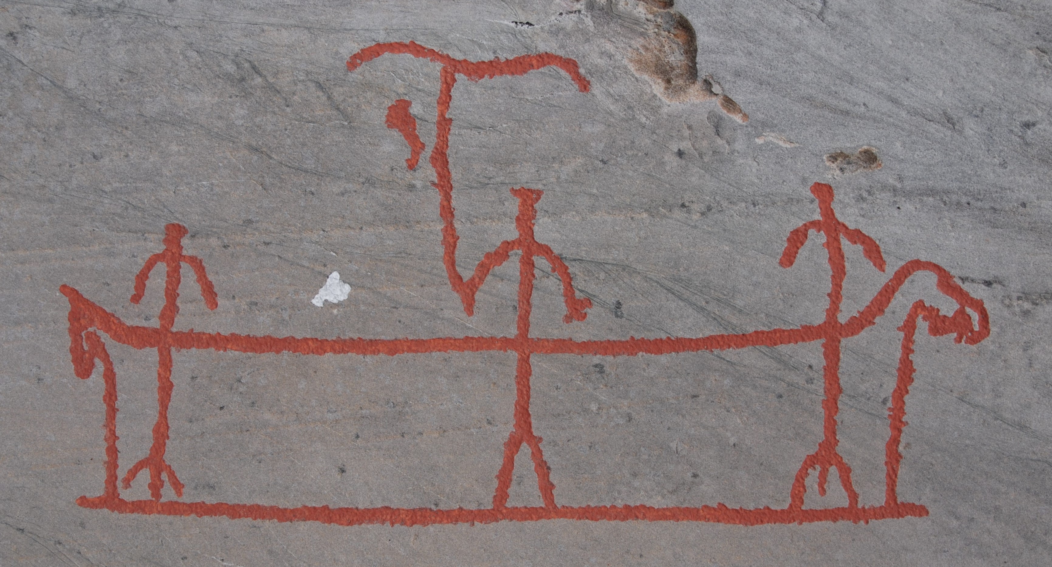
(Alta, Hjemmeluft, Bergbukten3A, Norway, ca 4000 BC).
Egyptian rulers have been sailing during the Early Bronze Age (ca. 3300-2100 BC), i.a. Pharaoh Khufu-Cheops importing copper from the Sinaï (ca. 2570 BC), Sneferu (ca. 2575 BC), Sahure (ca. 2450 BC) of the 4th and 5th dynasties sending ships to Byblos for wood and to Puntland for exotic goods[11].
Note that over time, the ships that initially set sail for Puntland from Ayn Sukhna and Wadi al-Jarf in the Gulf of Suez, gradually moved southwards to Marsa Gawasis, Myos Hormos and Berenike. This must be due to the wind climate on the Red Sea and to improved roads leading to Nile valley via the Eastern Desert.
Note also that the great pyramid builders of the 4th – 5th – 12th dynasties have also been great seafarers.
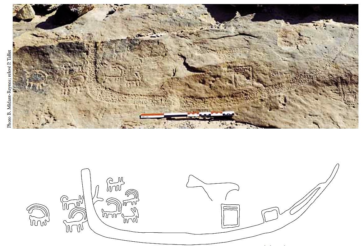
Similar petroglyphs are found at Rod el-Air near near Serabit el-Khadim (Pomey, 2012) in the Egyptian Eastern Desert (Lankester, 2012) and other examples are shown on vases of the same Gerzean period (e.g. British Museum N° 35324, 35502 & 36326) and on the handle of the so-called Gebel el-Arak knife.
Minoans from Crete were probably the first “professional” merchant seafarers sailing internationally in the Mediterranean area. This spanned, in round figures, the period between 2000 BC and 1500 BC.
Egyptians developed river and sea ships for 2000 years during the 3rd and 2nd millennia BC[14]. Between 2000 and 1800 BC, several pharaohs of the 12th dynasty sent expeditions on the Red Sea from Marsa Gawasis to the Land of Punt, to bring back exotic goods. Around 1450 BC, Queen Hatshepsut also sent a fleet to the Land of Punt, this time from Myos Hormos (Quseir).
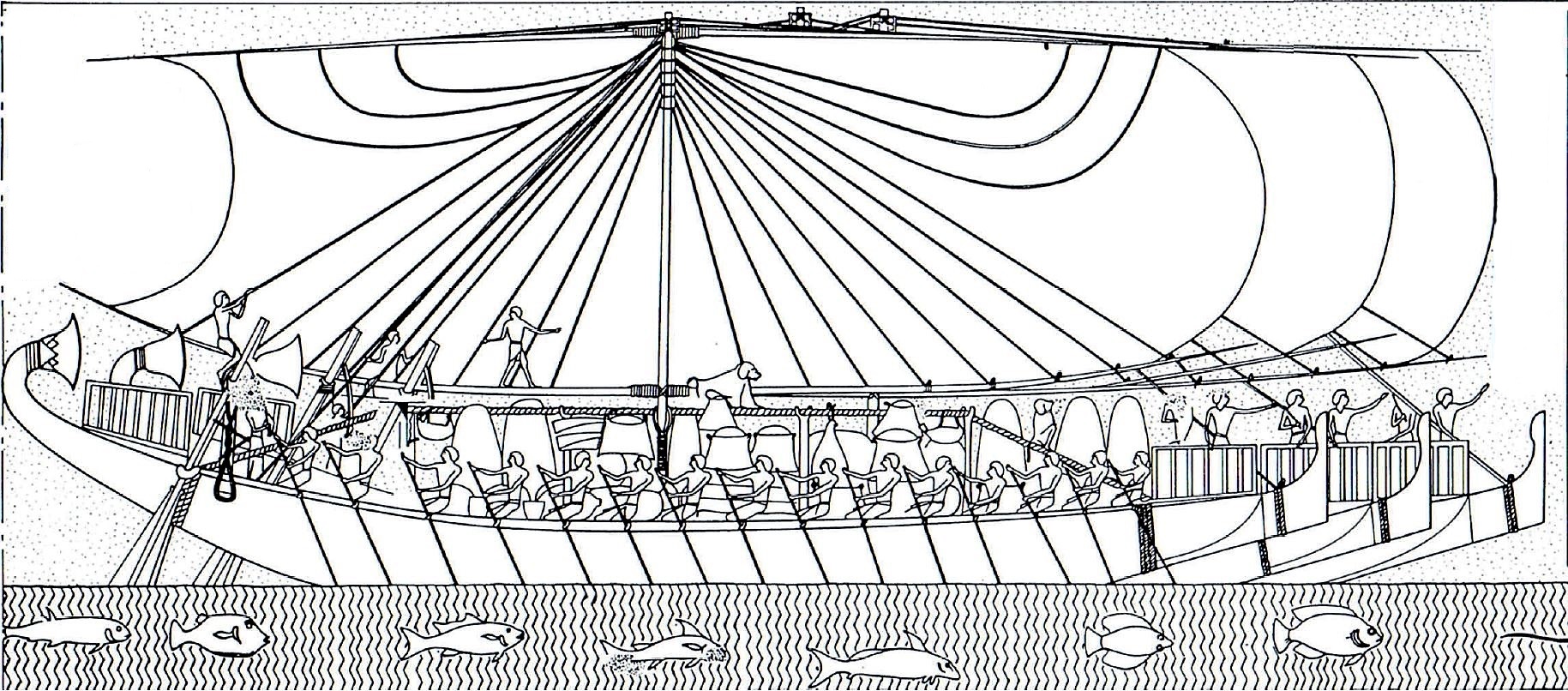
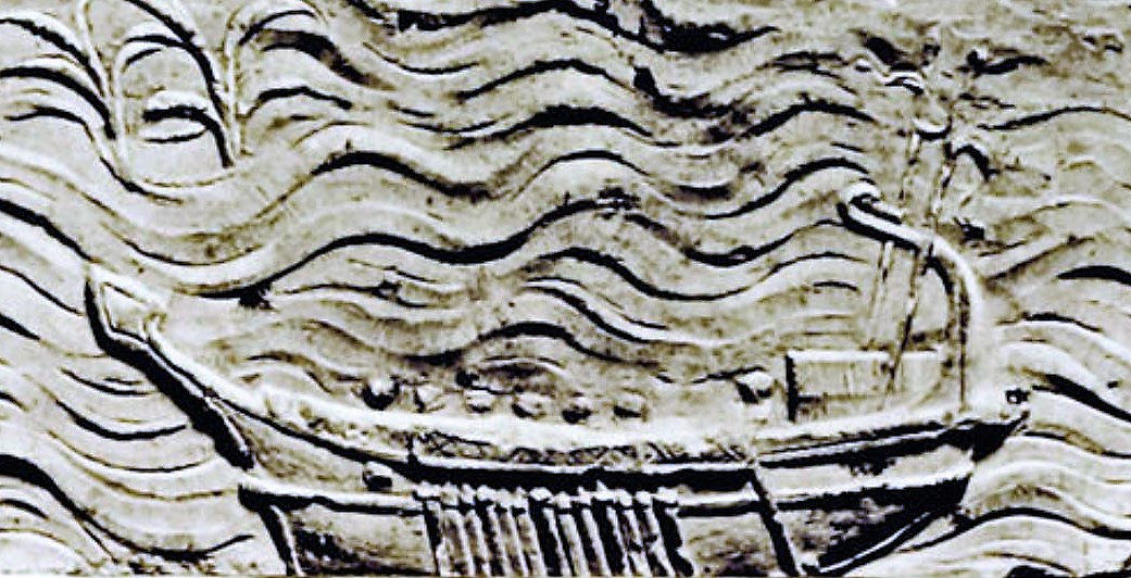
Later on, Ramesses II won a famous battle against the Sea Peoples ca. 1277 BC and provided shipbuilding assistance to the Hittites in ca. 1258 BC (Tablet KUB III 82 found at Boghazkoy/Hattusa[15] [16]). Ramesses III’s war ships are shown on the Medinet Habou relief (ca. 1180 BC) where it can be noted that the lower yard has been removed so that the sail has a lose foot[17]. This is a major development that enables sailing closer into the wind direction, and it can perhaps be seen as opening the way to the lateen sail concept that will emerge around 1400 years later.
After this, Egyptian and Mycenaean seafarers seem to vanish from the scene while Phoenician seafarers appear. Between 1200 and 600 BC, Phoenicians were involved mainly in (fairly) peaceful maritime trade, sailing all over the Mediterranean Sea and beyond, but very few written or iconographic documents of this period came down to us[18]. The Bible mentions “Tarshish ships” and “Byblos ships” several times, probably meaning large ships sailing respectively for metals to Tartessos in the south of Spain and for timber to Byblos in Lebanon. As the name “Tarshish ship” was also used in other areas like the Red Sea, we can assume that it refers to a type of ship rather than to a destination. This terminology was possibly inherited from the Egyptian Old Kingdom times[25].
In this period, the Egyptian pharaoh Necho II sent an expedition to circumnavigate Africa (ca. 600 BC).
This period was followed by the better known “Greek Classical Period” (500-323 BC), the “Hellenistic Period” (323-31 BC) and the Roman period[19].
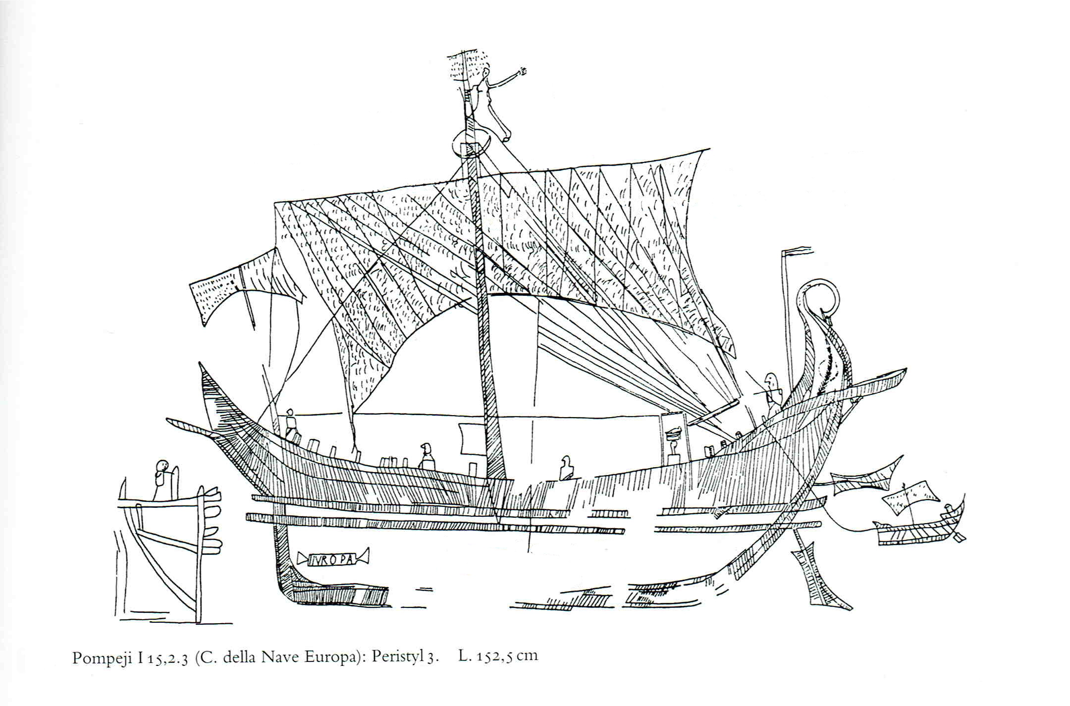
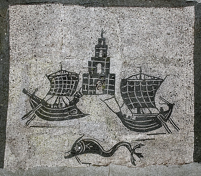
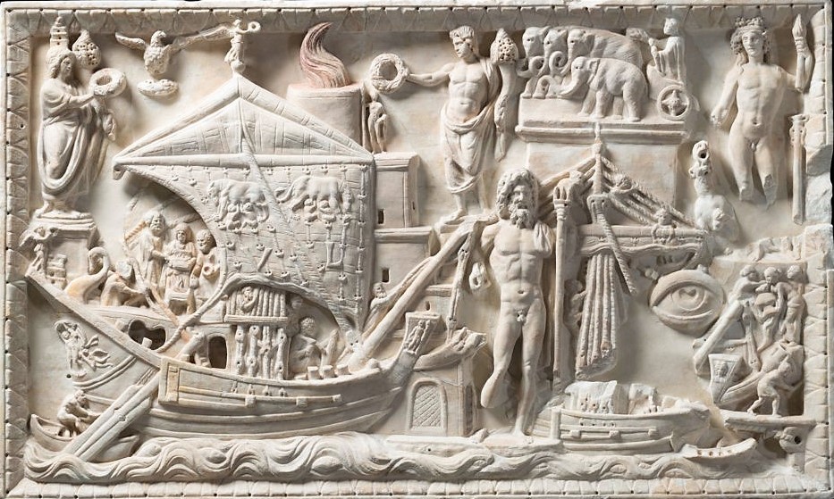
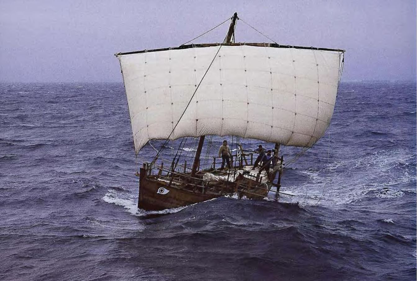
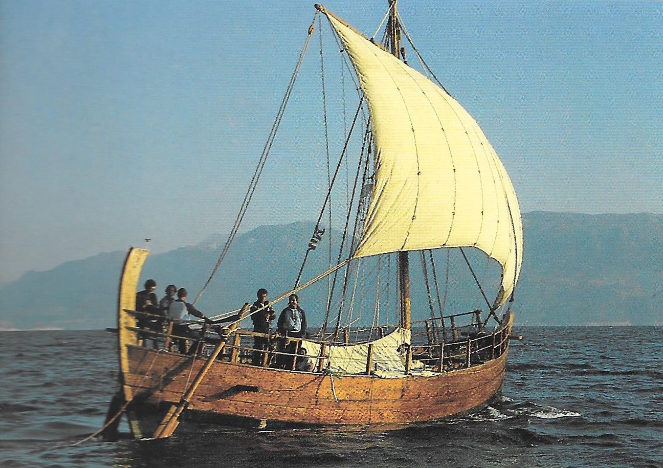
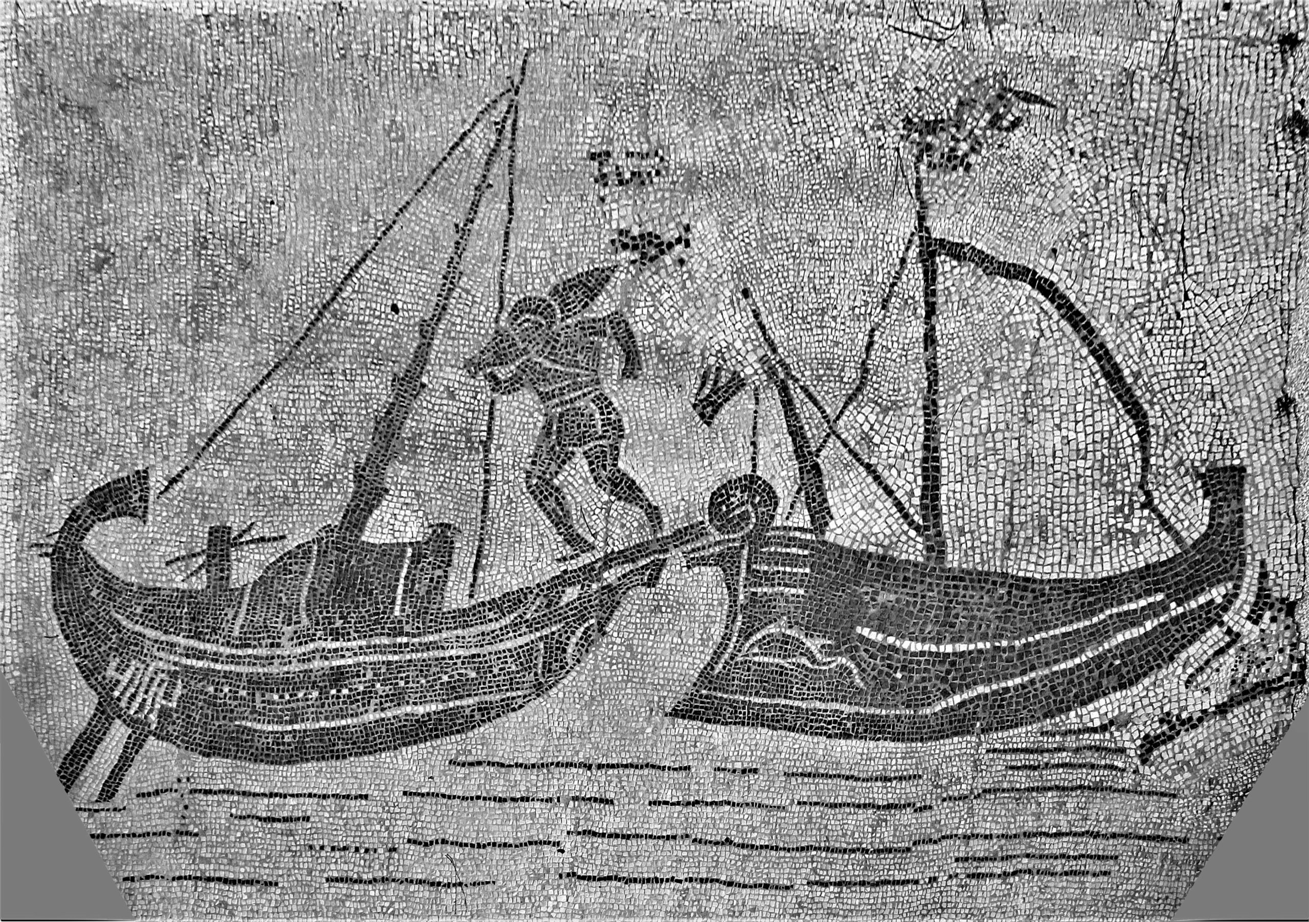
Early large Greek merchant ships of the Kerkouros type with combined rowing and sailing capacity seem to have been in use between 500 BC and 100 BC[20]. They could carry an average of 250 tons of cargo, up to 500 tons. Their average dimensions may have been 21 x 3 m, with 1:7 beam over length ratio, up to 50 x 7 m for the larger ones.
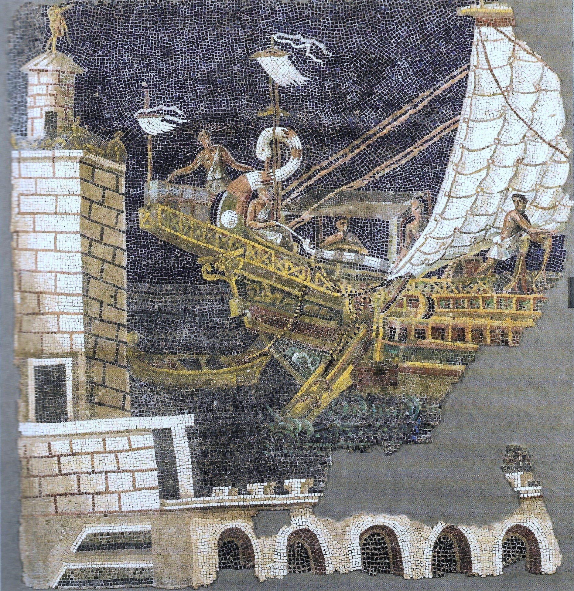
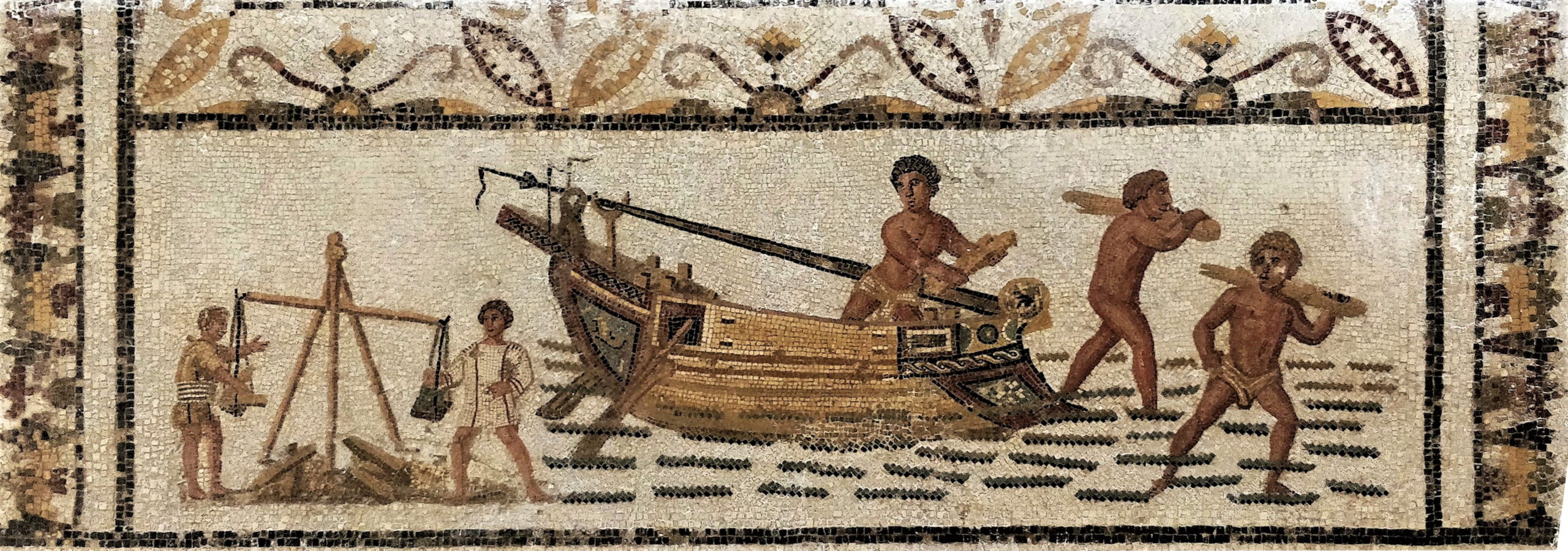
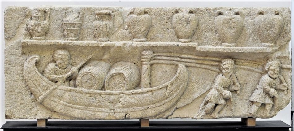
It may be noted also that Kerkouros ships usually docked stern first, while later ships also docked bow first as shown on the Torlonia relief. Alongside docking was needed if heavy cargo was to be lifted by cranes (live animals, barrels).
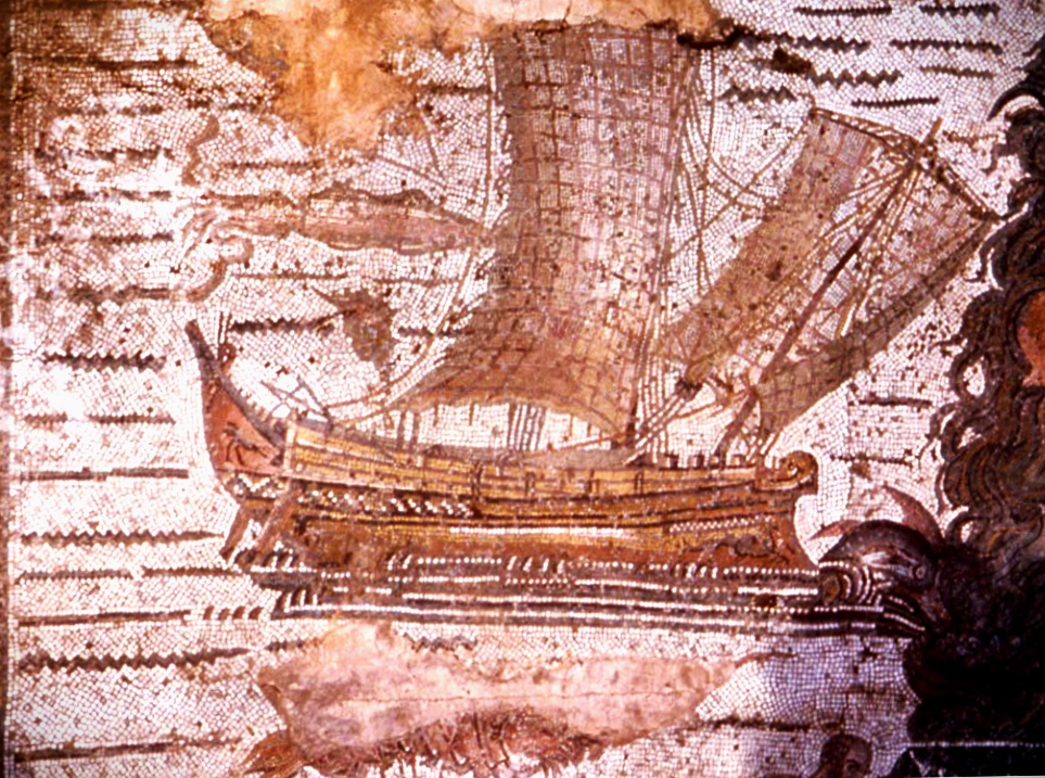
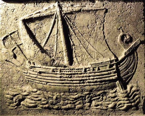
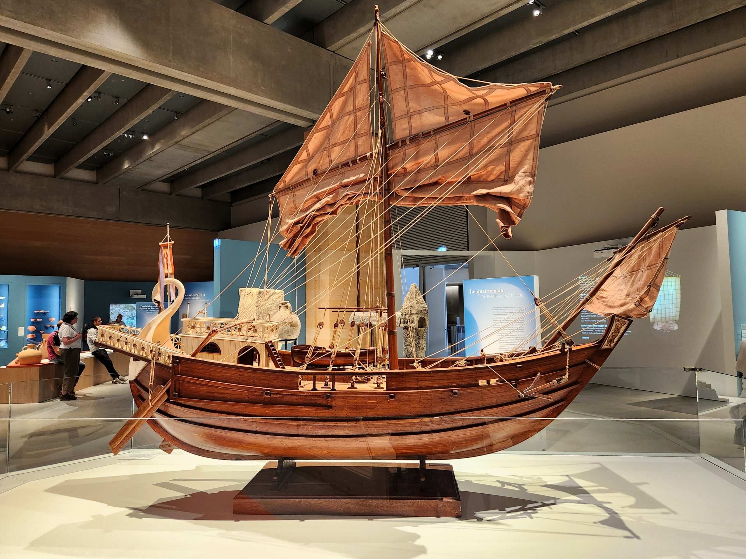
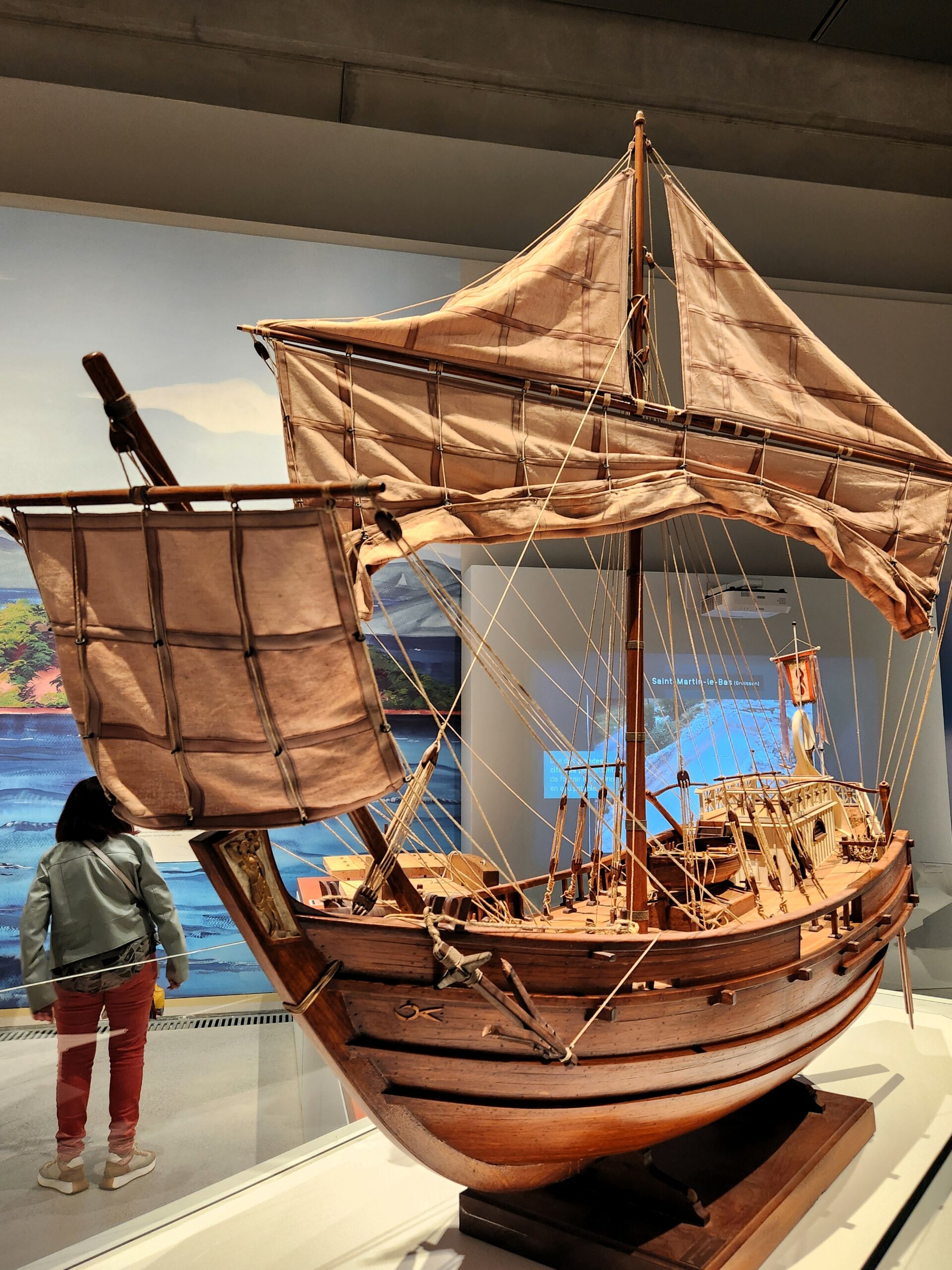
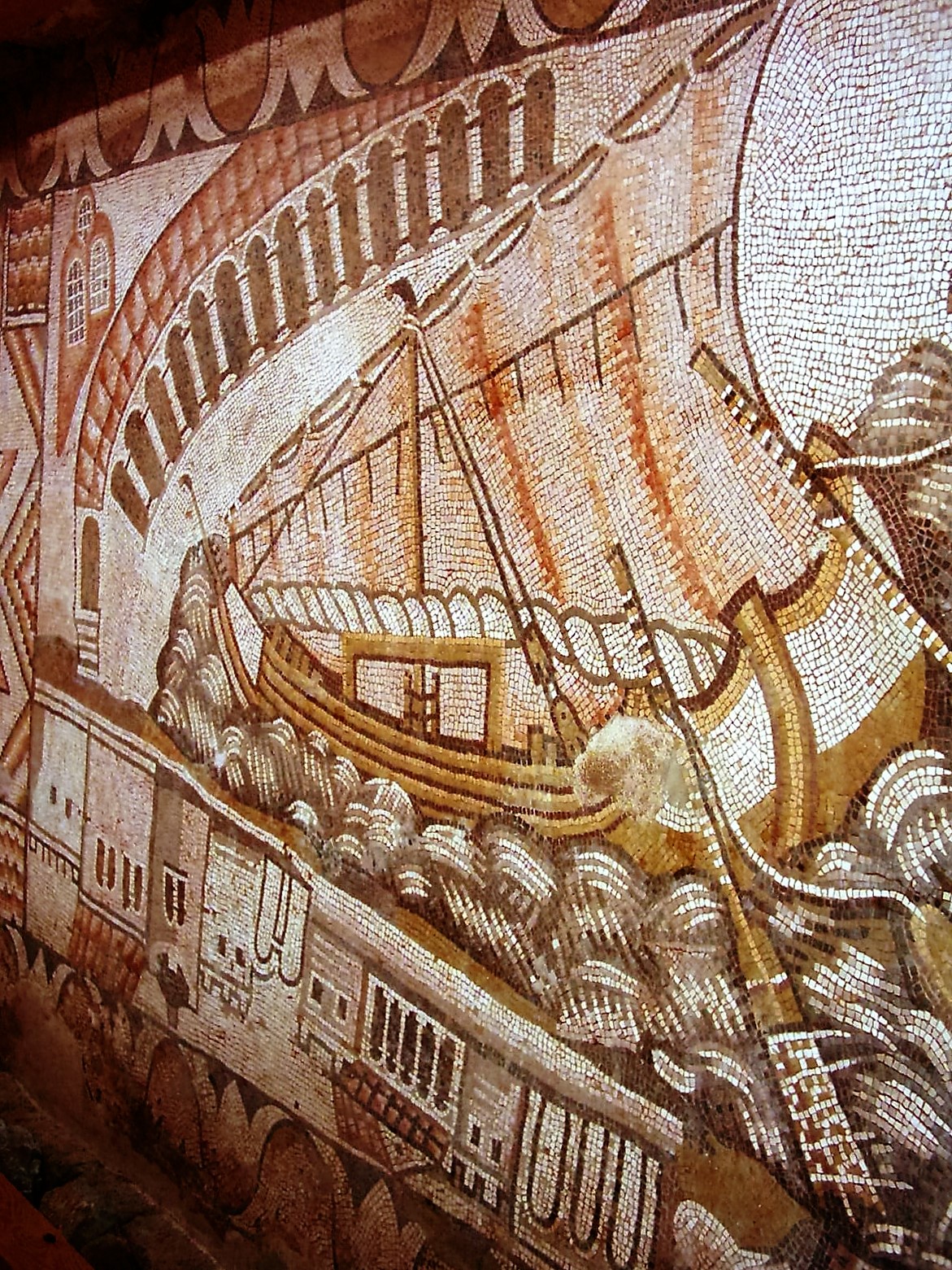
Later ships were more bulky and had no significant rowing capacity anymore, like the Roman Corbita type with 1:4 beam over length ratio. Exceptional ships like the Isis, 55 x 14 m, could carry 1200 tons with around 4.5 m draught, but normal ships ranged between 20 and 50 m for 100 to 500 tons of cargo with up to 3.5 m draught. Both concave bows (sharp bulbous bow, also called ‘cutwater’) and convex (rounded) bows were in use (see Foro delle Corporazioni at Ostia mosaïc below). The stern was quite high as these ships could easily be overtaken by waves travelling at 10 to 20 knots during a storm.
")
The Muziris Papyrus (ca. 150 AD) is a fragmentary document found in 1985[21]. On its verso side, it provides a list of cargo which has been reconstructed as follows: 544 tons of pepper, 76 tons of malabathron (cinnamomum tamala leaves), 3 tons of ivory tusks and 0.5 ton of ivory fragments, 2 tons of tortoise shell, and 80 boxes of Gangetic nard (possibly 1 or 2 tons)[22]. That is a payload of ca. 628 tons, requiring a very large Roman ship (this one was called the Hermapollon). The total value of this cargo reaches a stunning amount of 9.2 million Roman sesterces, which is around 90 million modern Euros[23].
Most of our knowledge is taken from shipwrecks that tell us about the ships and about their content. Amphorae were stowed vertically, protected by bales of straw and secured with ropes. Copper and tin ingots were placed at the bottom of the hold, acting as ballast. It is believed that wheat was carried in sacks of one artaba (ca. 30kg) for easy loading/unloading. The port(s) of origin can often be guessed from the content of the ship, but the port of destination is usually more difficult to identify. It may be said that large ships (and a few smaller ones) were sailing on the long haul between major hubs, but that local redistribution was conducted by small ships only[24]. See “Maritime trade” for more on this subject.
Many web sites provide further information, e.g. Navis, Navistory, Navigation dans l’Antiquité.
Notes
[9] GJERDE, J.M., 2019, “An overview of Stone Age rock art in northernmost Europe – what, where and when?”, in Rock Art of the White Sea, Cambridge, (p 204-224), and
GJERDE, J.M., 2019, “Alta (Norway), Rock Art of”, in Encyclopedia of Global Archaeology, C. Smith (ed.), (10 p).
[10] PHILIPPE, M., 2023, “L’arbre qui cache la forêt: Métaphore de la pirogue monoxyle dans l’enregistrement archéologique des premières navigations européennes, une approche méthodologique”, in: Actes du 29e Congrès préhistorique de France, 31 mai-4 juin 2021, Toulouse, (p 111-127).
[11] MARCUS, E., 2002, “Early Seafaring and Maritime Activity in the southern Levant from Prehistory through the Third Millennium BCE”, in van den Brink & Levy eds, Egypt and the Levant, interrelations from the 4th through the Early 3rd millennium BCE, New approaches to Anthropological Archaeology, (p 403-417).
See also Wikipedia: https://en.wikipedia.org/wiki/Sahure
[13] TALLET, P. & LAISNEY, D., (2012), “Iry-Hor et Narmer au Sud-Sinaï (Ouadi ‘Ameyra) – Un complément à la chronologie des expéditions minières égyptiennes”, Bulletin de l’Institut Français d’Archéologie Orientale, Tome 112, Le Caire, 2012, (p 381-398). Location near 29.198°N, 33.233°E.
[14] POMEY, P., 2015, « Navires et construction navale dans l’Égypte ancienne », in Entre Nil et mers, la navigation en Egypte ancienne », edt B. Argémi & P. Tallet, Actes des rencontres de Provence Égyptologie, Musée Départemental Arles Antique, le 12 avril 2014.
[15] POMEY, P., 2006, « Le rôle du dessin dans la conception des navires antiques. À propos de deux textes akkadiens », in L’Apport de l’Égypte à l’histoire des techniques. Edt B. Mathieu, D. Meeks, M. Wissa, Méthodes, chronologie et comparaisons, BdE 142, Cairo.
See also discussion Pomey, 2009 and Bash, 2009.
[16] EMANUEL, J., 2014, « Sea Peoples, Egypt, and the Aegean: The Transference of Maritime Technology in the Late Bronze–Early Iron Transition (LH III B–C) », Aegean Studies, No. 1, 2014, (p 21-56), online publication December 1, 2014.
[17] See note above
[18] VAN ALFEN, P., 2015, « Phoenician Trade: An Overview », Working Paper v.31.3.2015.
[19] For a superb overview of the Roman history, have a look at: BADEL, C. & INGLEBERT, H., 2014, “Grand Atlas de l’Antiquité romaine – Construction, apogée et fin d’un empire”, éd. Autrement, Paris, (191 p).
[20] ARNAUD, P., 2012, “La mer, vecteur des mobilités grecques”, in “Mobilités grecques”, Capdetrey & Zurbach (edt.), Scripta Antiqua 46, Ausonius, Bordeaux, (p 89-135).
[21] CASSON, L., 1990, “New Light on Maritime Loans: P.Vindob. G 40822”, in Zeitschrift für Papyrologie und Epigraphik 84, (pp 195-206), gives a complete translation into English. The papyrus is presently housed in the Austrian National Library in Vienna. It is one of the very few surviving maritime contracts presently available to us (see also: http://papyri.info/ddbdp/sb;3;7169 ).
[22] DE ROMANIS, F., (2012), “Playing Sudoku on the Verso of the ‘Muziris Papyrus’: Pepper, Malabathron and Tortoise Shell in the Cargo of the Hermapollon”, Journal of Ancient Indian History, 27, (pp 75-101), gives a brilliant reconstruction of the cargo on board the Hermapollon. See also his 2014 conference: http://www.college-de-france.fr/site/jean-pierre-brun/seminar-2014-12-09-10h00.htm
[23] 1 Roman sesterce = 6.5 €, based on the fairly low annual salary of a 1st century soldier or worker of 1000 sesterces/year (i.e. one denarius = 4 sesterces = 16 asses per day, acc. to Tacitus, Annals, I, 17, and on 250 days/year), compared to the French lowest revenue (RSA) of 6 420 €/year in 2016 for a single man.
See also: https://web.archive.org/web/20130210071801/http://dougsmith.ancients.info/worth.html
[24] BOETTO, G., 2012, “Les épaves comme sources pour l’étude de la navigation et des routes commerciales: une approche méthodologique”, in: Rome, Portus and the Mediterranean, edt. S. Keay, British School at Rome, Oxbow Books.
[25] TALLET, P., 2023, “Entre mer Rouge et côtes du levant. La navigation maritime des égyptiens sous l’ancien empire“, Cahiers de la villa « Kérylos », no 33. La redécouverte du Levant, (p 23-47).