Location: 40.82160N 14.11540E
Puteoli
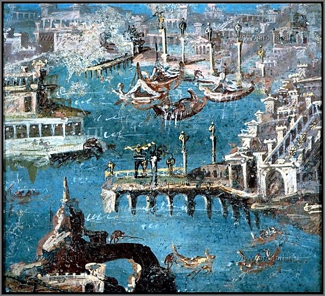
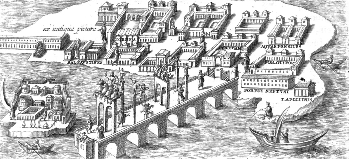
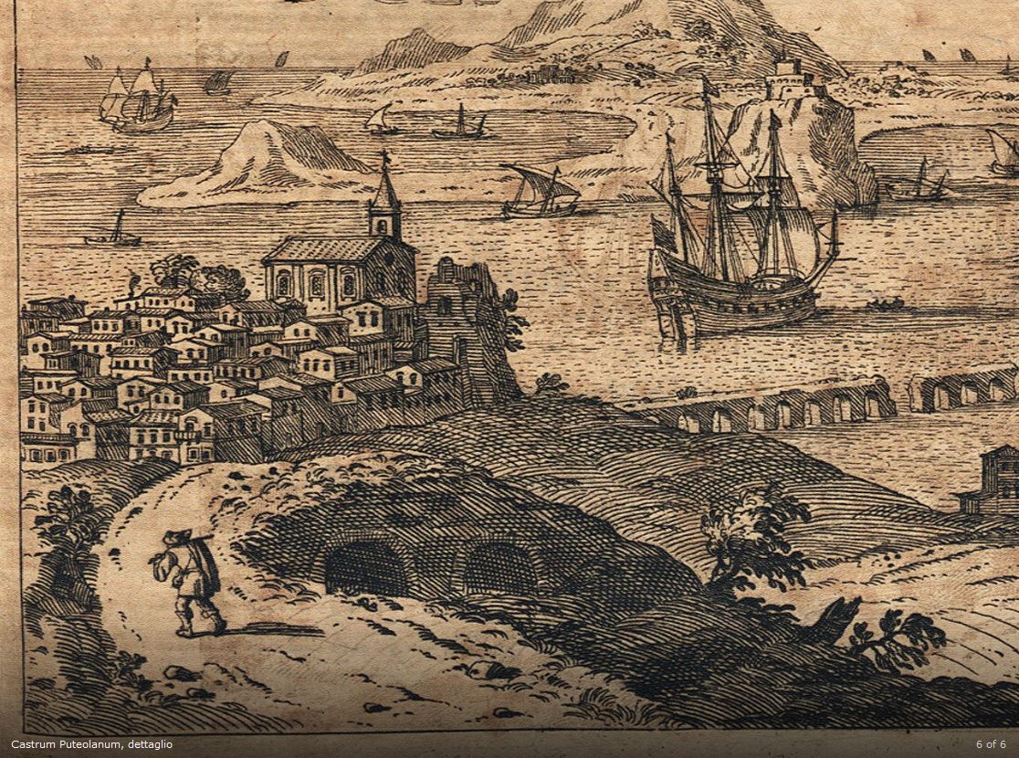
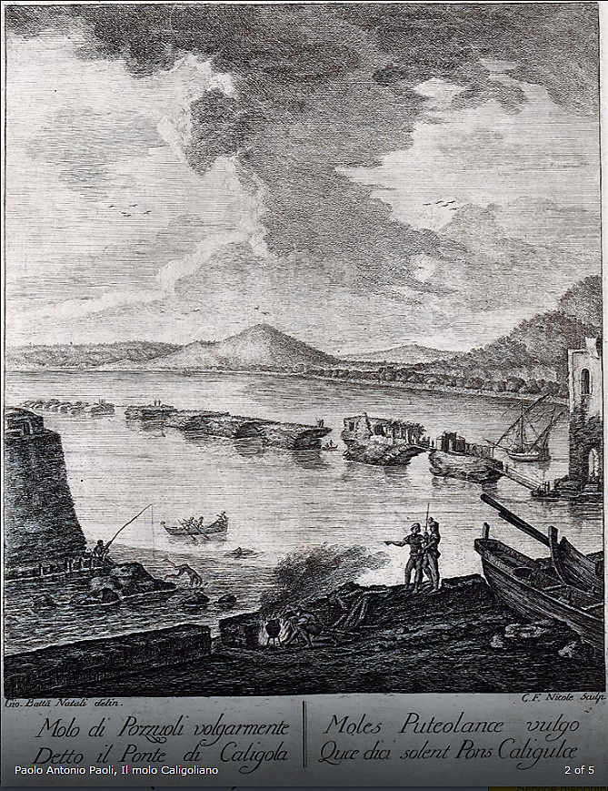
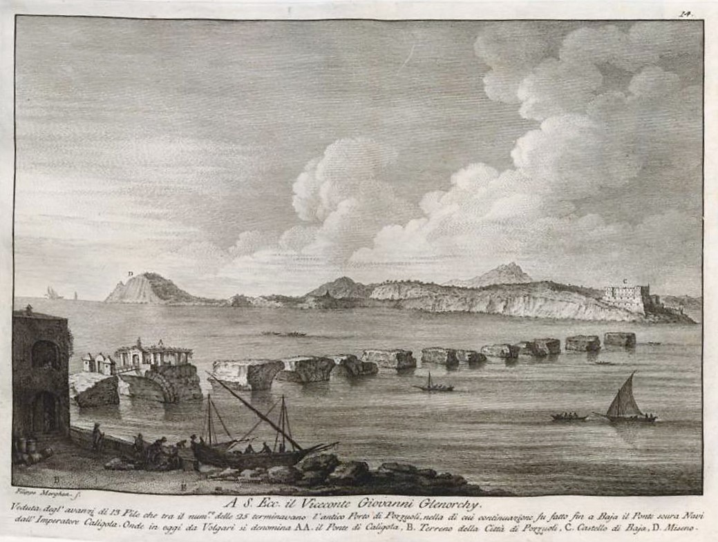
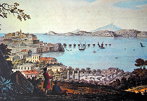
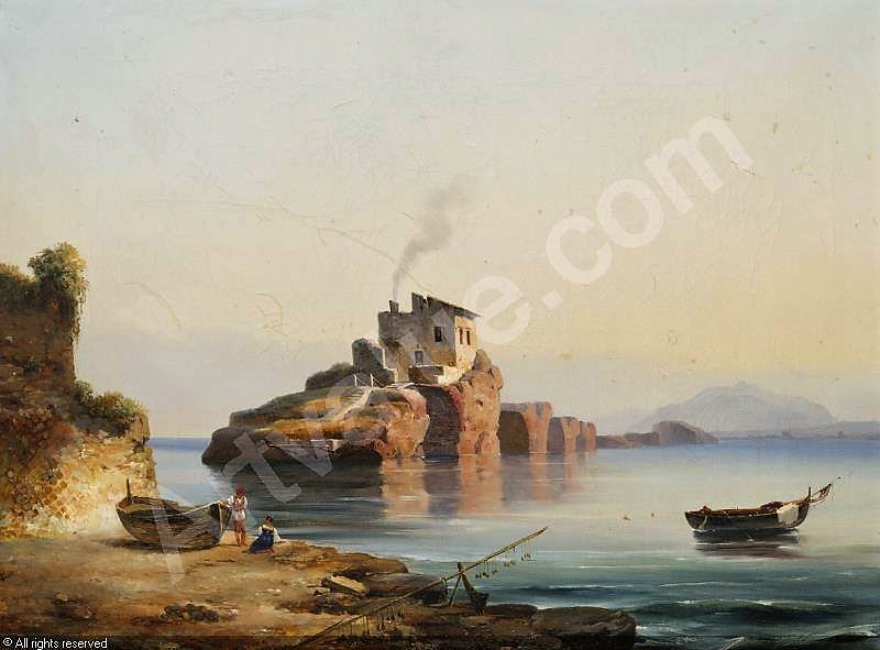
Puteoli (now Pozzuoli) was a major Roman port. It was sheltered by the most famous arched breakwater resting on pilae. This breakwater was buried under the modern breakwater (!) but it was still visible in the 19th c. and known as “Molo Caligoliano”:
 (source: Wikipedia ) |
 |
 (source: http://www.archeoflegrei.it/i-souvenir-di-puteoli/) |
 (source: https://web.uvic.ca ) See also: Picard, C. (1959) « Pouzzoles et le paysage portuaire », Latomus, T. 18, Fasc. 1, pp. 23-51. |
 (source: http://www.archeoflegrei.it/i-castra-flegrei/) |
 (source: http://www.archeoflegrei.it/portodiputeoli/) |
 |
 |
 |
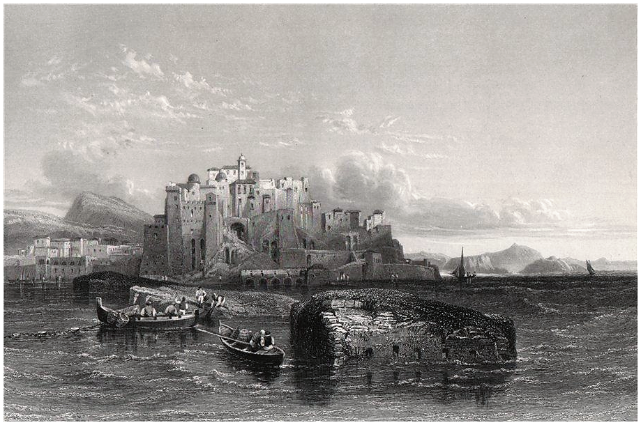 |
It can be seen from the dates of these pictures that the pilae were still in place in the 19th century. They were covered by a modern breakwater in the early 20th century.
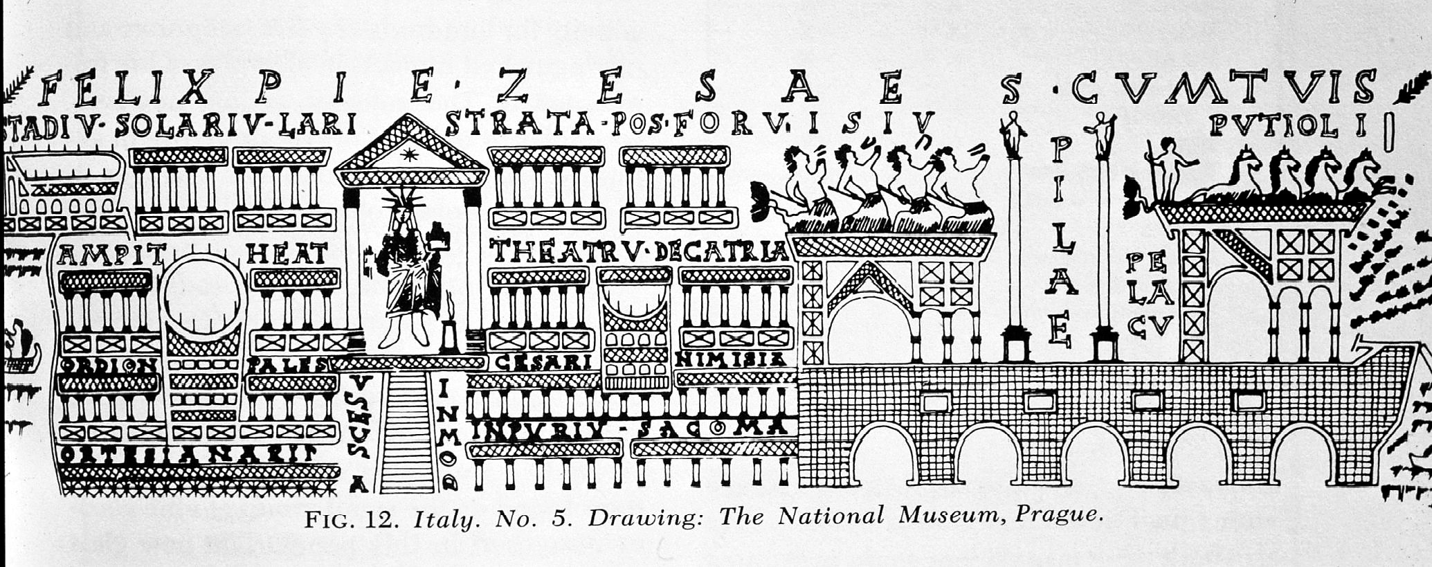
Paolo Antonio PAOLI, provided the dimensions of the ancient arched structure in his “Antichita di Pozzuoli” in 1768 (with some later editions, including Giuliano DE FAZIO in 1828).
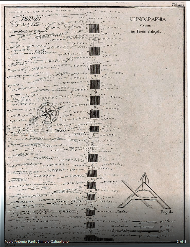
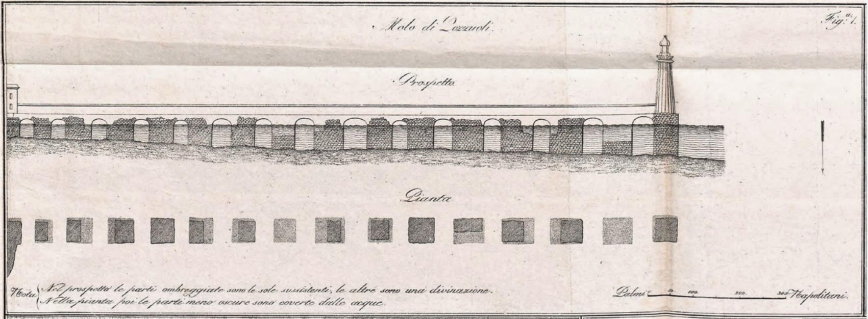
The drawings show 15 pilae (including 2 submerged pilae) over a distance of 372 m (acc. to C. Dubois, 1907[1]). However, the inscription CIL X.1641 dated 139 AD, mentions repairing 20 pilae and adding a new protection embankment (“munitione”). In his Book of Phtomyris (1, 53) Chaeremon (ca. 85 AD) even speaks of “around 30 arches”. The largest pilae of ca. 15 x 15 m are at the offshore end of the structure. The nearshore pila is somewhat smaller: ca. 8 x 12 m. The opening between adjacent pilae (8 to 11 m) varies from 0.5 to 0.9 pila width, which is close to the values found for the pilae of Portus Iulius and Misenum.
The area north of the structure had to be protected from waves incoming from south and the arched structure cannot have been very efficient as a breakwater. On the other hand, the massiveness and the height of this structure above the seawater level makes it even less acceptable as a simple jetty for loading/unloading ships, even if some mooring stones have been found.
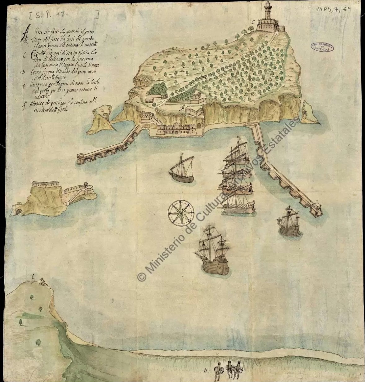
Nesis
Nesis (now Nisida) is located about 5 km SE of Puteoli and had a similar arched breakwater which could still be seen in 1635:
(source: http://www.archeoflegrei.it/storia-del-lazzaretto-dellisola-di-nisida/mpd_07_069-21-aprile-1635-conde-de-monterrey-al-rey/ ).
The best-preserved remaining pila is at the NE side of the island and was studied in detail by Mattei et al.[2] showing its large dimensions (ca. 14.5 x 14.5 m) and deep-water location (ca. 10 m now, and ca. 7 m in Roman times). It may be noted that this structure is very similar, but more exposed to SW wave attack than the one in Puteoli.
A very peculiar, and puzzling, aspect of this pila is the presence of opus reticulatum at its bottom end. Pictures are provided by Mattei (2018) and also by Brandon (2008)[3] at 6 m water-depth on a nearby place called Secca Fumosa (a third example is known at Egnazia on a 6 m water-depth). The divers show cubilia blocks of 8-10 cm (Secca Fumosa) and 15 cm (Nesis) which are neatly arranged, and it must be concluded that this work had to be performed in dry conditions as it is hard to imagine Roman divers doing such a job 7 m below the water surface. We then have two options: either the block was built in a dry-dock on land, either it was built inside a watertight cofferdam in the sea.
In the cofferdam option, it thus stood on a 7 m water-depth and keeping it upright and watertight would be a remarkable feat. The cofferdam would be reinforced by vertical and by horizontal beams (the imprints of 7 horizontal beams were found at Nesis near the ancient water level). Similar beams would also have been used near the bottom of the cofferdam in order to take-over the tremendous lateral water pressure (7 ton/m2). In addition, the side walls would have to be deeply driven into the subsoil in order to prevent seepage. A layer of hydraulic concrete would have to be poured on the bottom of the cofferdam before pumping water out, to provide a plug against seepage and horizontal support for the foot of the cofferdam walls. However, this plug should have a mass large enough to counterbalance a 7 m high water pressure and this would require around 4.5 m of hydraulic concrete with a unit weight of around 1.6 t/m3. This simply does not allow opus reticulatum near the seabed.
In the second option, the block would, at least partly, be built on land in a dry-dock, it would have to be floated to its location and then lowered down to the seabed, some 7 m below the water surface. According to Golvin[4], a wooden caisson would be filled partly in-the-dry with hydraulic concrete and include an opus reticulatum facing. The dry-dock containing the caisson would then be flooded and the caisson would float. Considering a unit weight of around 1.6 t/m3 for hydraulic concrete and 1.0 t/m3 for wood and for water, a 2.5 m layer of hydraulic concrete in the caisson would yield a 4 m draught when the caisson is floating. This would be convenient for leaving a 5 m deep dry-dock with 1 m keel clearance. Once on site, the caisson would be tethered to prepositioned barges and the filling with hydraulic concrete would continue until the caisson would touch the seabed (when the layer of hydraulic concrete reaches ca. 4.5 m). After that, the filling with hydraulic concrete would continue until reaching the water surface. Above water, the filling might consist of traditional masonry or concrete without pozzolana.
Partial onshore prefabrication of such large pilae is thus a huge entreprise, but it seems easier than completely building them in a cofferdam at sea.
It must be noted that, in both cases, it would not have been required to use hydraulic concrete that may be cast under water: traditional concrete would suffice. However, the builders may have been aware of the better longevity of hydraulic concrete in seawater.
Notes
[1] DUBOIS, C., 1907, « Pouzzoles Antique (Histoire et Topographie) », Paris. He was one of the last observers of the ancient breakwater as he visited the place during construction of the modern breakwater on top of the ancient one. He estimates that many arches were 10 m wide, and that most pilae were 16 x 16 m. They were made of hydraulic concrete for their underwater part and of dry masonry for their emerged part (that was also underwater when Charles Dubois saw it, because of a ca. 2 m subsidence). He also suggested a double row of pilae in a staggered arrangement, but archaeological evidence is poor.
[2] MATTEI, G., TROISI, S., AUCELLI, P., PAPPONE, G., PELUSO, F., STEFANILE, M., 2018, “Sensing the Submerged Landscape of Nisida Roman Harbour in the Gulf of Naples from Integrated Measurements on a USV”, Water 2018, 10, 1686, (31 p).
[3] BRANDON, C., 2008, “The Concrete Construction of the Roman Harbours of Baiae and Portus Iulius, Italy: The ROMACONS 2006 field season”, The International Journal of Nautical Archaeology (2008), 37.2, (p 374–392).
[4] COULON, G., and GOLVIN, J-C., 2020, “Le Génie maritime romain”, Actes Sud/Errance, (201 p).