Location: 42.095N 11.788E
The port of Centumcellae was built by order of Trajan by the famous architect Apollodorus of Damascus in the years 105-110 AD. The construction of one of the breakwaters was witnessed by Pliny the Younger (Letters, 6, 31) who provided us one of the very few descriptions of the construction of a Roman rubble mound breakwater in 107 AD :
“a broad barge brings up a number of immense stones, which are thrown into the water, one on top of the other, and these are kept in position by their own weight, and gradually become built up into a sort of breakwater. […] Subsequently, concrete (pilae) will be added to the stones”, transl. J.B. Firth (1900).
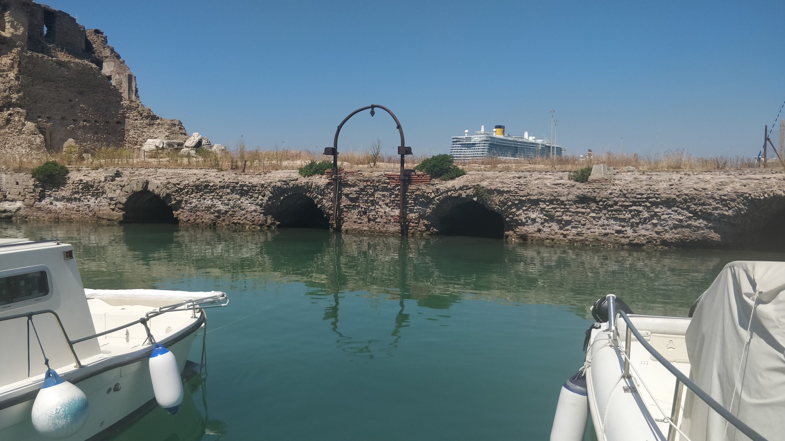
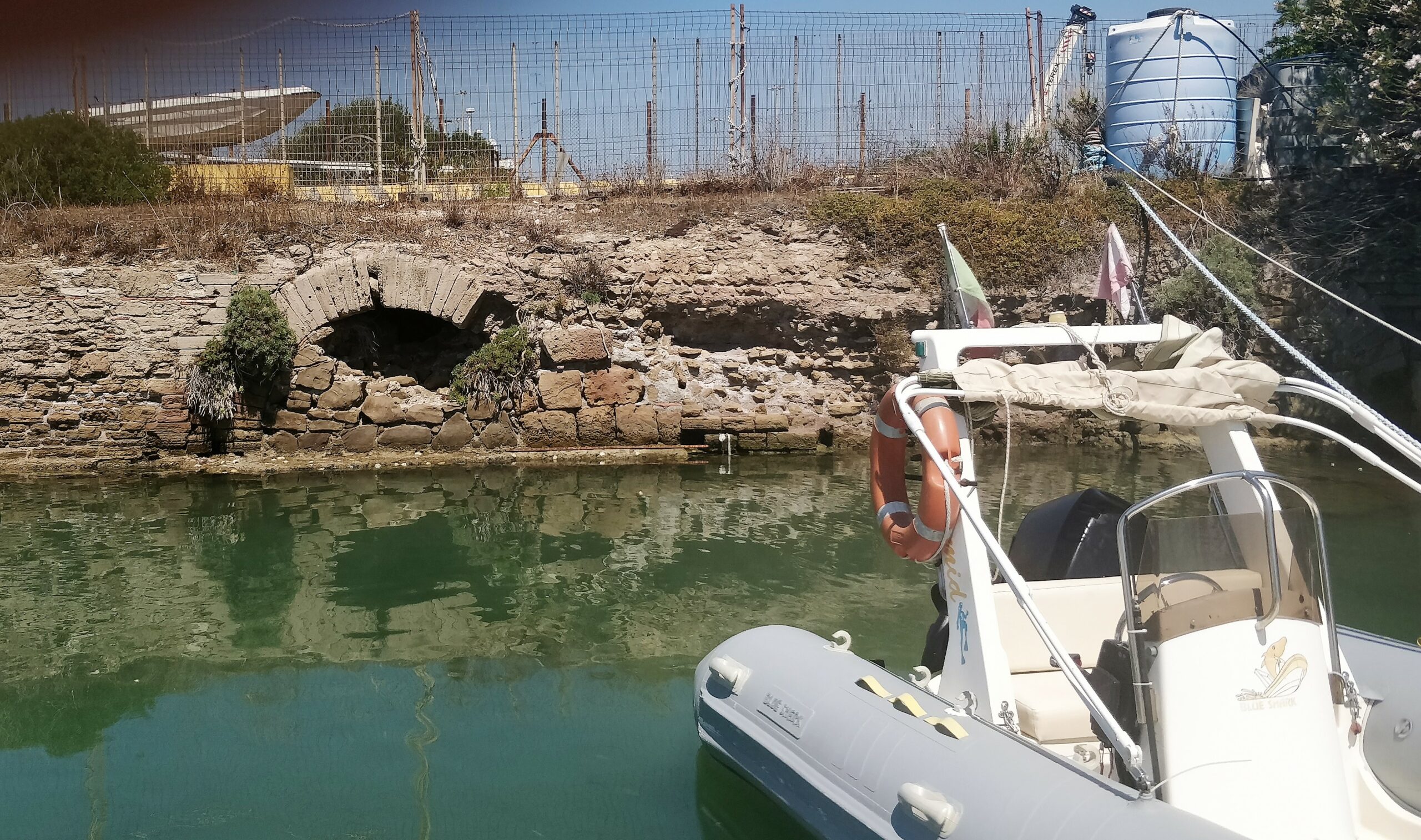
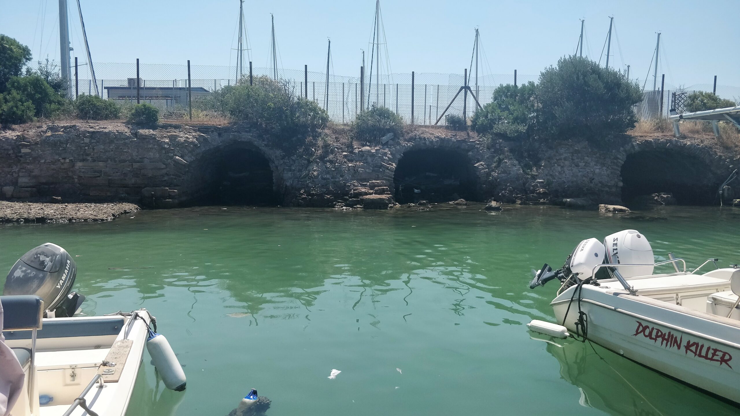
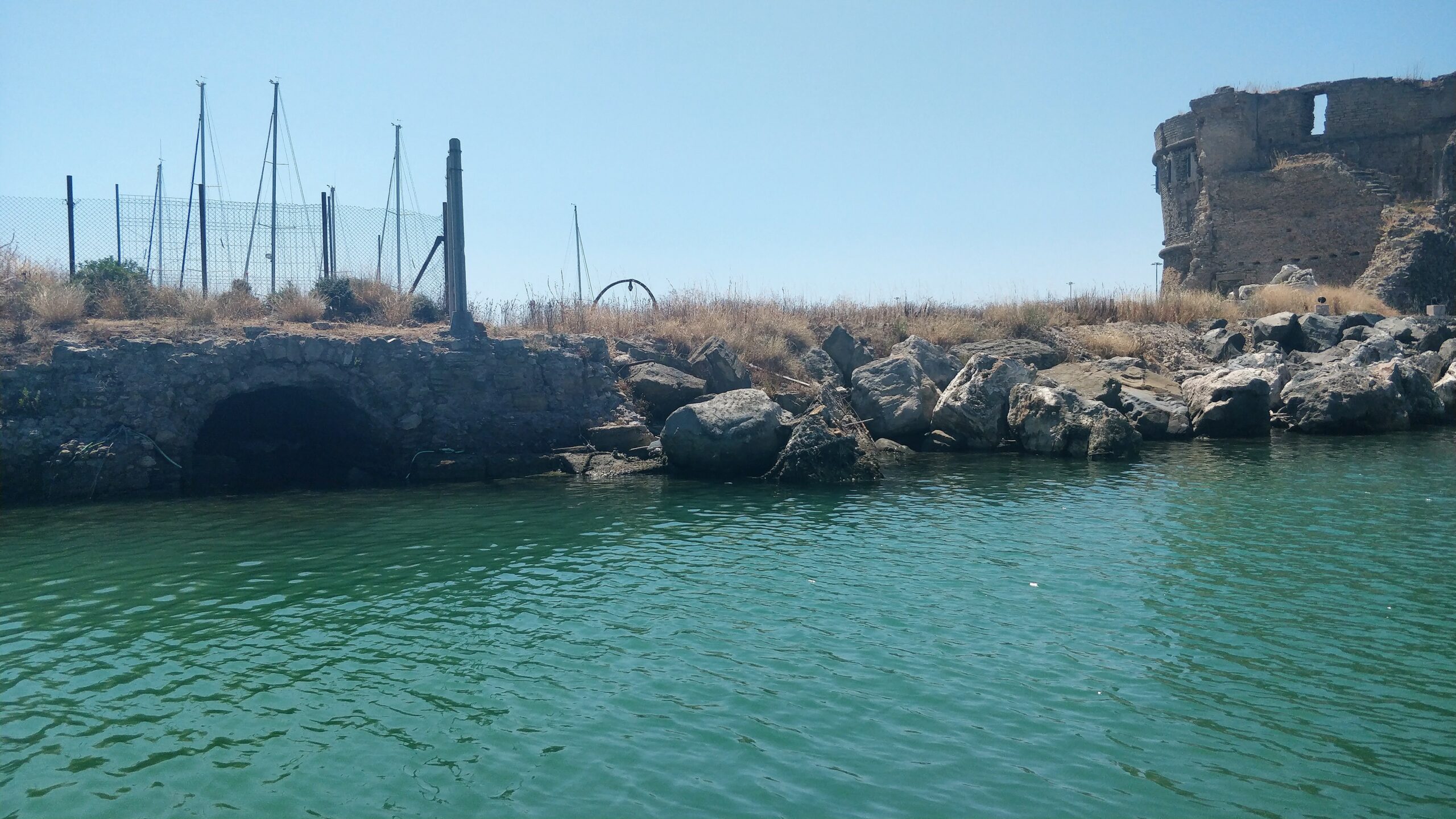
Today’s Molo del Lazzaretto is the only Roman arched breakwater still visible in the Mediterranean world. Acc. to Quilici (2004) it stands on a 3-3.5 m water depth (ca. 0.80 m less in Roman times) and reaches 2.5 m above modern Mean Sea Level (ca. 3.3 m above Roman MSL). The remaining length is ca. 100 m, out of a 250 m initial length, with 8 arches remaining today. Its width was 11 m in Roman times, which was enlarged later to ca. 20 m in order to support the “Lazzaretto”. The arches are around 2.3 m wide, with a pila width of ca. 5.3 m between the arches. The horizontal dimensions of the pilae are therefore 5.3 x 11 m and the opening is 2.3/5.3 = 0.43 pila width.
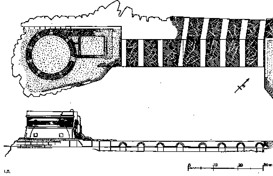
As it was built in the early 2nd c. AD, this structure may have inherited from previous experience with flushing a harbour without allowing excessive wave penetration. This may perhaps have resulted in the modest 2.3 m width of its ducts which would possibly provide a better balance between flushing capacity and wave penetration than in the larger structures like at Puteoli. It may then come as a surprise that similar arched breakwaters did not survive elsewhere. However, it is noteworthy that the 6th c. enlargement introduced an angle in the ducts, as if this was intended to further reduce wave penetration. Moreover, ducts N° 5, 6, 7 and 8 have been closed by masonry on the south side and ducts N° 1, 2 and 3 were obstructed by rock dumped on the north side at the toe of the tower. These modifications seem to point at a need for further reducing wave penetration entering the harbour basin from north to south.
.
References
DAVID, M., STASOLLA, F., ZACCAGNINI, R., 2018, “Nuove ricerche nel territorio di Civitavecchia. Un progetto per Aquae Tauri”, SCIENZE DELL’ANTICHITÀ, Vol. 24, (p 149-174).
MAFFEI, A., 2017, “La città e il porto di Civitavecchia – Centumcellae. Approdo dei navigator Tirreni. Scalo di Roma”, Civitavecchia 2017.
NOLI, A., 2015, “il porto di Centumcellae dall’epoca di Traiano all’inizio del ventunesimo secolo”, L’Acqua 4-5/2015, (p 47-58).
QUILICI, L., 2004, “Per il restauro del faro del Lazzaretto a Civitavecchia”, in M. Giacobelli (ed.), Lezioni Fabio Faccenna: conferenze di archeologia subacquea (III-V ciclo), Bari 2004, (p 111-118).
ZACCAGNINI, R., 2021, “Da Centumcellae a Civitavecchia. Una rilettura delle fasi di sviluppo del porto attraverso le nuove indagini sul molo del Lazzaretto”, Entre Mares Congress, 3-5/11/2021, Irun, Spain.
And on Roman Ports.org.