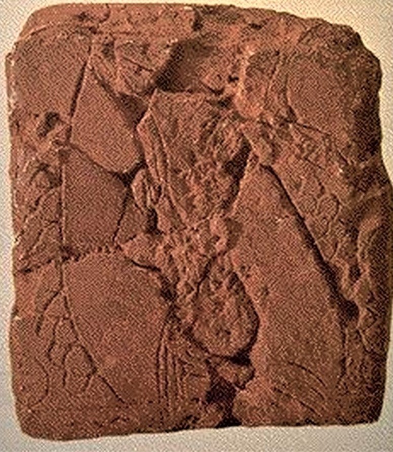
Ga-Sur map showing a river valley, ca. 2500 BC, found in 1930 at Yorghan Tepe (Nuzi), near Kirkouk, Iraq (0.076 x 0.068 m, top is south) (University of Harvard Mus.)
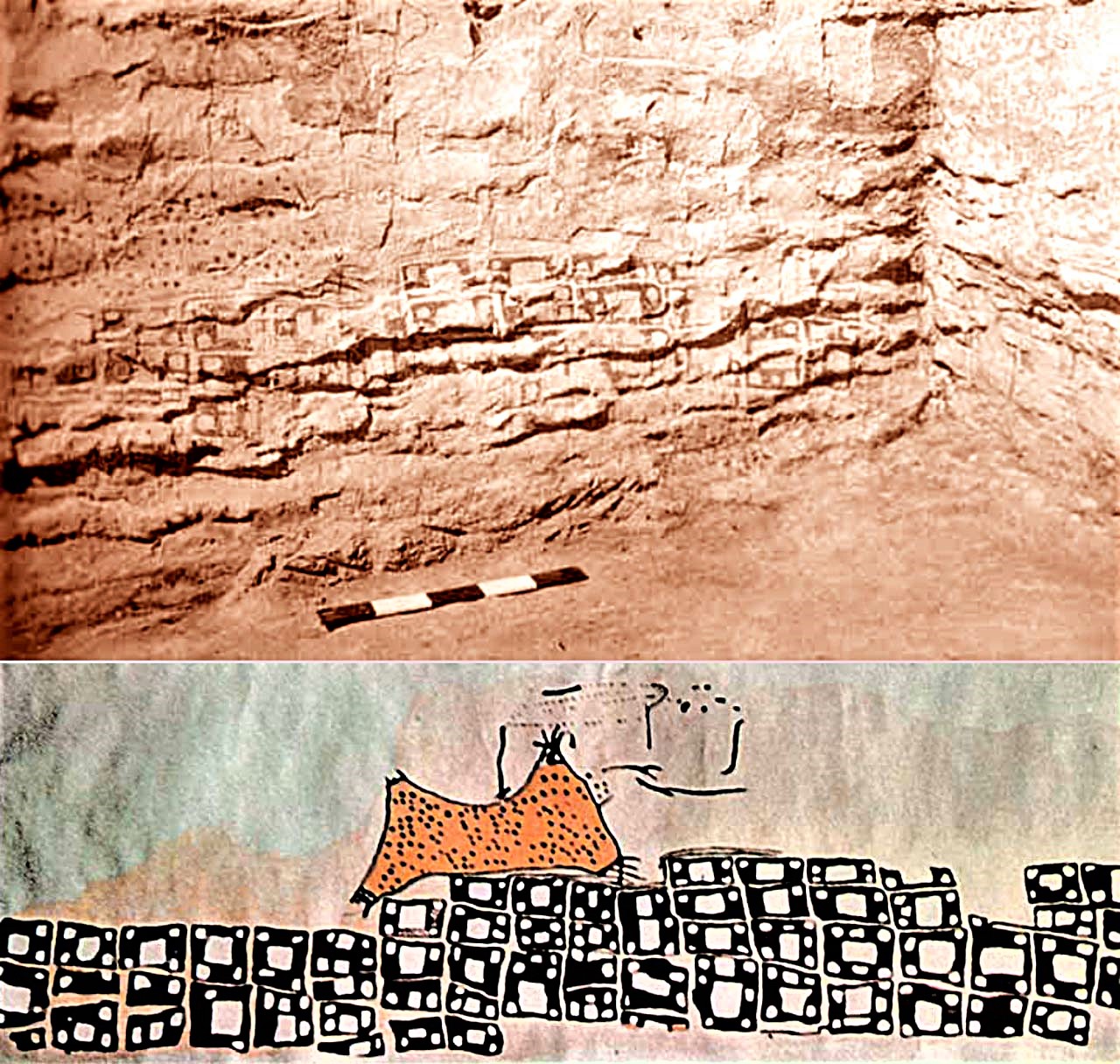
Nippur map showing the city with its walls, temples and canals, ca. 1300 BC, found around 1899 at Nippur (Irak) (0.21 x 0.18 m) (University of Pennsylvania Mus.)
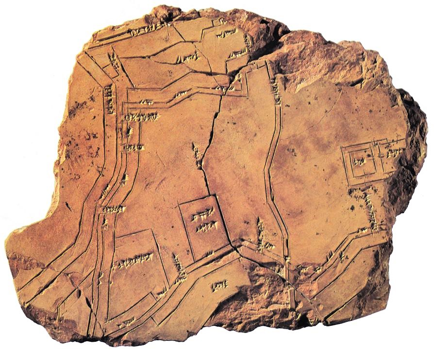
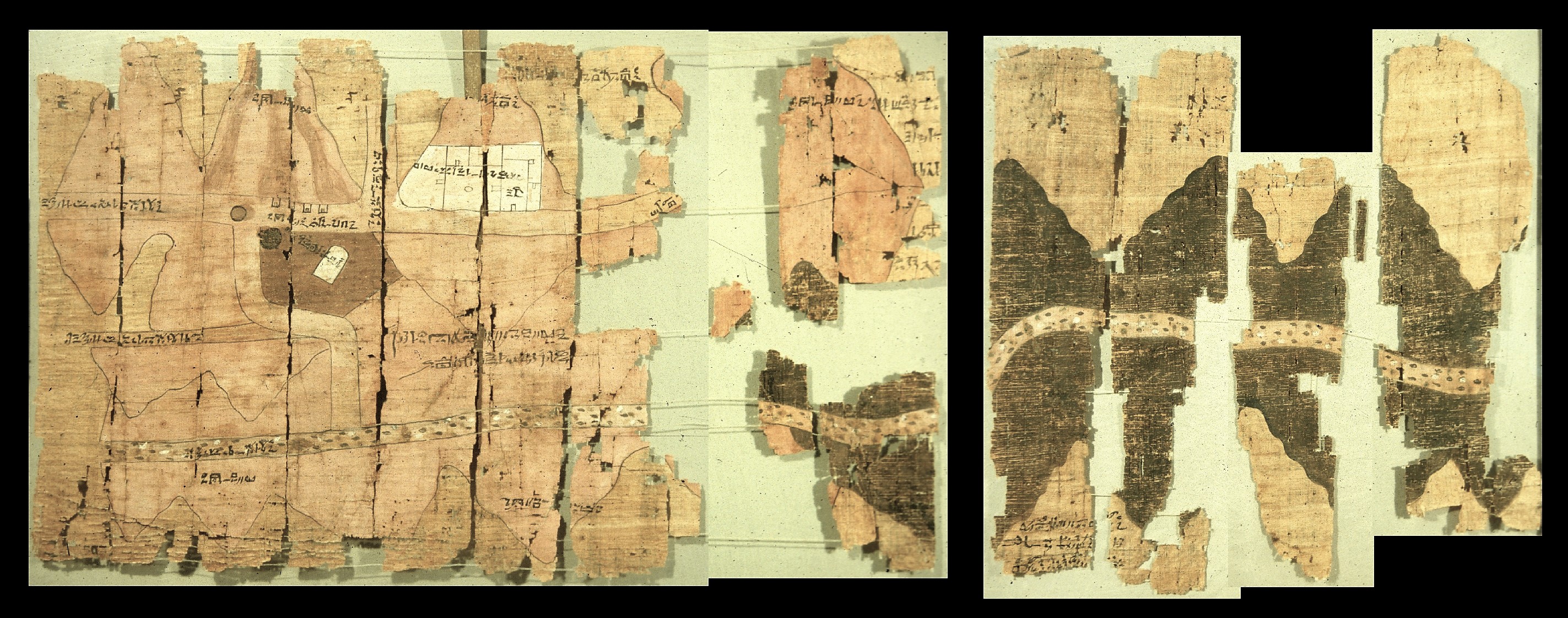
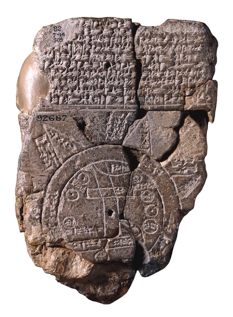
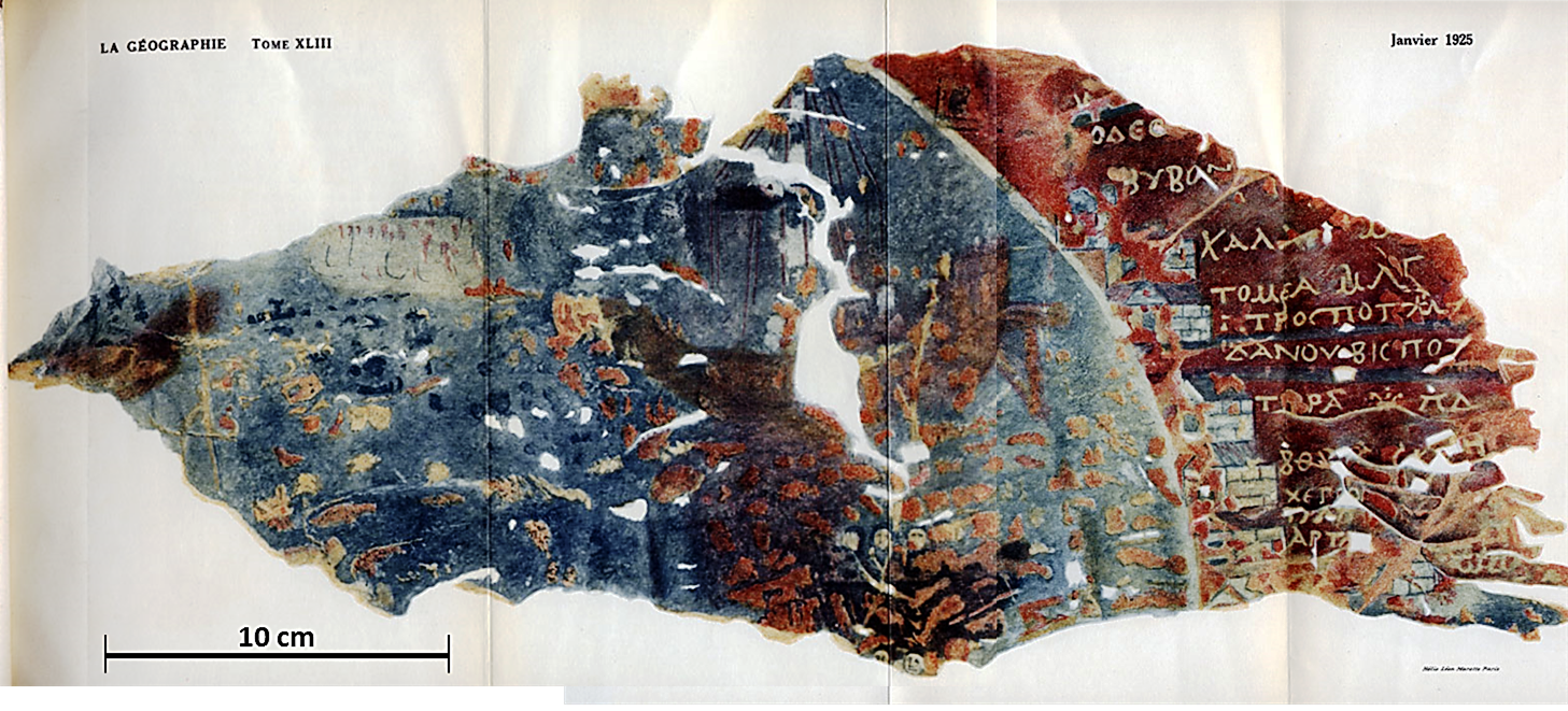
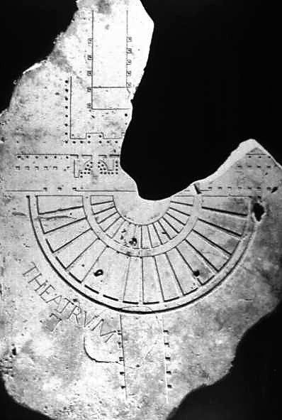
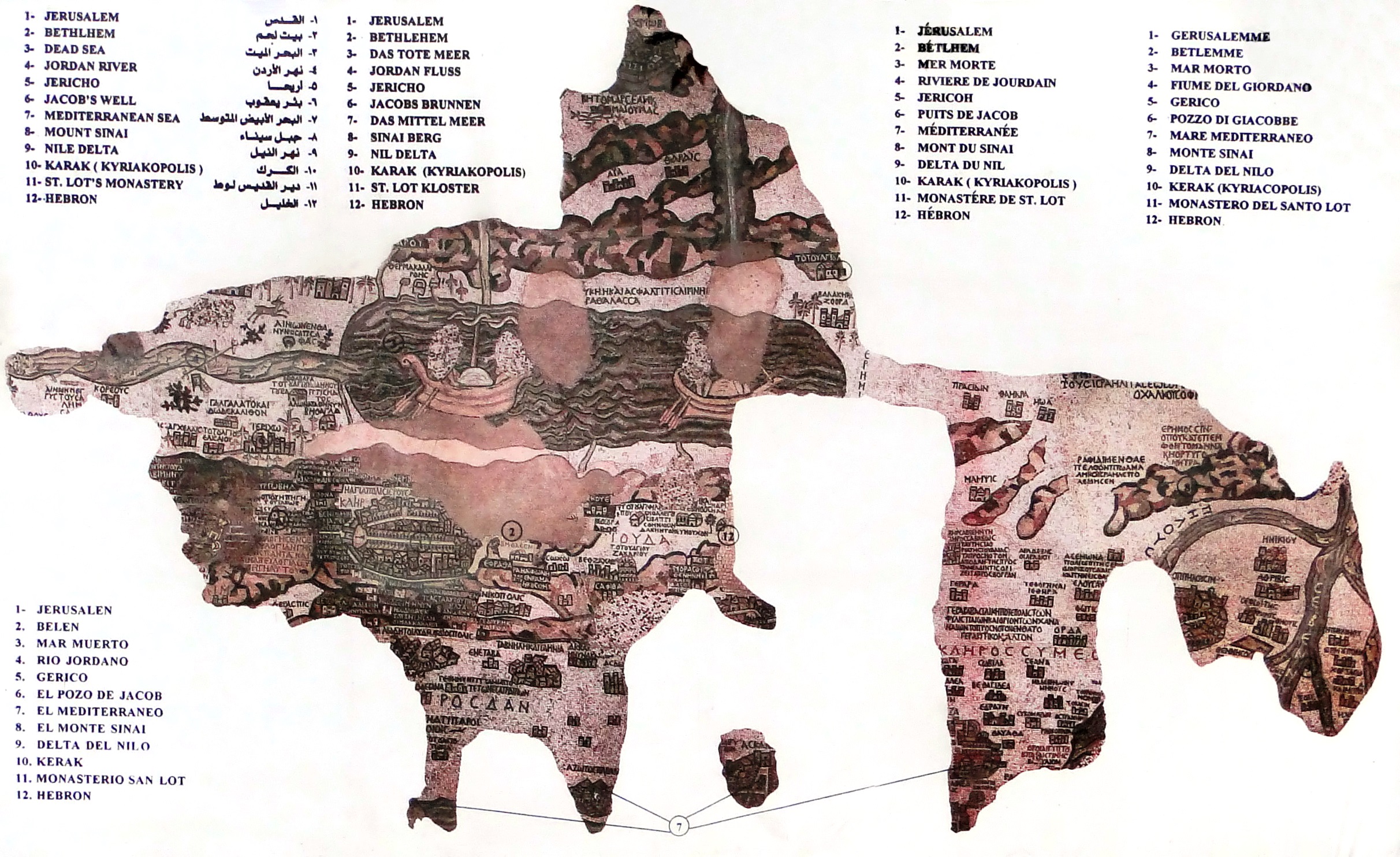
Turin Papyrus (eastern part) showing the Wadi Hammamat gold mine, ca. 1150 BC, found by B. Drovetti around 1820 at Deir el-Medina (Egypt). (2.10 x 0.41 m, top is south). (Torino Mus.)Imago Mundi clay tablet, showing the Babylon area, ca. 6th c. BC, found by H. Rassam in 1882 at Sippar (Irak), (0.122 x 0.082 m, top is north), (British Mus. N° 92687).Marbres d’Orange tabula, showing the cadastral map of the Roman colony Julia Firma Arausio Secundanorum (77 AD) consisting of three maps (the largest is 7.56 x 5.90 m) (Orange Mus. picture A. de Graauw, 2020).Dura-Europos parchment, showing a part of the Black Sea coast, around 200 AD (acc. to P. Arnaud, 1990), found in 1923 by F. Cumont in Syria (0.45 x 0.18 m, top is East). (Wikipedia)Map of Rome, the Marble Plan, or Forma Urbis Romae, built around 203-211 AD on a wall of Templum Pacis (18.22x 12.87 m) (Wikipedia & Stanford Univ.)Madaba mosaic, showing Palestina, around 550 AD, probably based on a 3rd c. Roman map (acc. to P. Arnaud, 1990), found in 1896 in Jordan (15.7 x 5.6 m, top is East). (Wikipedia)