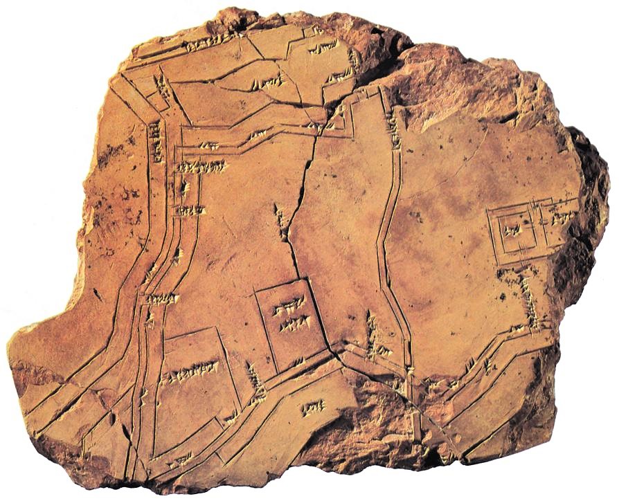
NippurMap
Nippur map showing the city with its walls, temples and canals, ca. 1300 BC, found around 1899
(0.21 x 0.18 m) (University of Pennsylvania Mus.)
https://pierrickauger.wordpress.com/2014/03/19/la-plus-ancienne-carte-du-monde/
Nippur map showing the city with its walls, temples and canals, ca. 1300 BC, found around 1899
(0.21 x 0.18 m) (University of Pennsylvania Mus.)
https://pierrickauger.wordpress.com/2014/03/19/la-plus-ancienne-carte-du-monde/