Location: 37.397N 25.264E
Possible beaching and quays are shown with dotted lines: nearly 200 m in the Sacred Port and 800 m in the commercial port.
Delos was a famous island because of its central position in the southern Aegean Sea, halfway between Athens and Asia Minor. As the birthplace of Apollo (and Artemis), it was a holy place. It became the headquarters of the 5th c. BC Delian League, and it also became a large emporium (Constantakopoulou, 2017).
The following story is told about Apollo’s mother, Leto, looking for a suitable place to give birth to her son (Homeric Hymn to Apollo, Hymn 3, lines 51-61, 8th – 7th c. BC):
“Delos, if you would be willing to be the abode of my son Phoebus Apollo and make him a rich temple; for no other will touch you, as you will find out: I think you will never be rich in oxen and sheep, nor bear vintage nor yet produce plants abundantly. But if you have the temple of far-shooting Apollo, all men will bring you hecatombs and gather here, and incessant savour of rich sacrifice will always arise, and you will feed those who dwell in you from the hand of strangers; for truly your own soil is not rich.” (Translation, H. G. Evelyn-White, 1914).
Thucydides (History of the Peloponnesian War, Book 3, Chap. 104, 426 BC) tells this story:
“The same winter the Athenians purified Delos, in compliance, it appears, with a certain oracle. It had been purified before by Pisistratus the tyrant; not indeed the whole island, but as much of it as could be seen from the temple. All of it was, however, now purified in the following way. All the sepulchres of those that had died in Delos were taken up, and for the future it was commanded that no one should be allowed either to die or to give birth to a child in the island; but that they should be carried over to Rheneia, which is so near to Delos that Polycrates, tyrant of Samos, having added Rheneia to his other island conquests during his period of naval ascendancy, dedicated it to the Delian Apollo by binding it to Delos with a chain.” (Translation, R. Crawley, 1903).
Plutarch tells a story also (Live of Nicias, Chap., around 420 BC):
“It is matter of record also how splendid and worthy of the god his lavish outlays at Delos were. The choirs which cities used to send thither to sing the praises of the god were wont to put in at the island in haphazard fashion. The throng of worshippers would meet them at the ship and bid them sing, not with the decorum due, but as they were hastily and tumultuously disembarking, and while they were actually donning their chaplets and vestments. But when Nicias conducted the festal embassy, he landed first on the neighbouring island of Rheneia, with his choir, sacrificial victims, and other equipment. Then, with the bridge of boats which he had brought along with him from Athens, where it had been made to measure and signally adorned with gildings and dyed stuffs and garlands and tapestries, he spanned during the night the strait between Rheneia and Delos, which is not wide. At break of day he led his festal procession in honour of the god, and his choir arrayed in lavish splendour and singing as it marched, across the bridge to land.” (Translation on Lacus Curtius, Loeb Classical Library, 1916).
Another story comes from Strabo (Geography, Book 14, Chap. 5, around 10 BC):
“The exportation of slaves induced them [pirates] most of all to engage in their evil business, since it proved most profitable; for not only were they easily captured, but the market, which was large and rich in property, was not extremely far away, I mean Delos, which could both admit and send away ten thousand slaves on the same day; whence arose the proverb, “Merchant, sail in, unload your ship, everything has been sold.” The cause of this was the fact that the Romans, having become rich after the destruction of Carthage and Corinth, used many slaves; and the pirates, seeing the easy profit therein, bloomed forth in great numbers, themselves not only going in quest of booty but also trafficking in slaves.” (Translation on Lacus Curtius, Loeb Classical Library, 1928).
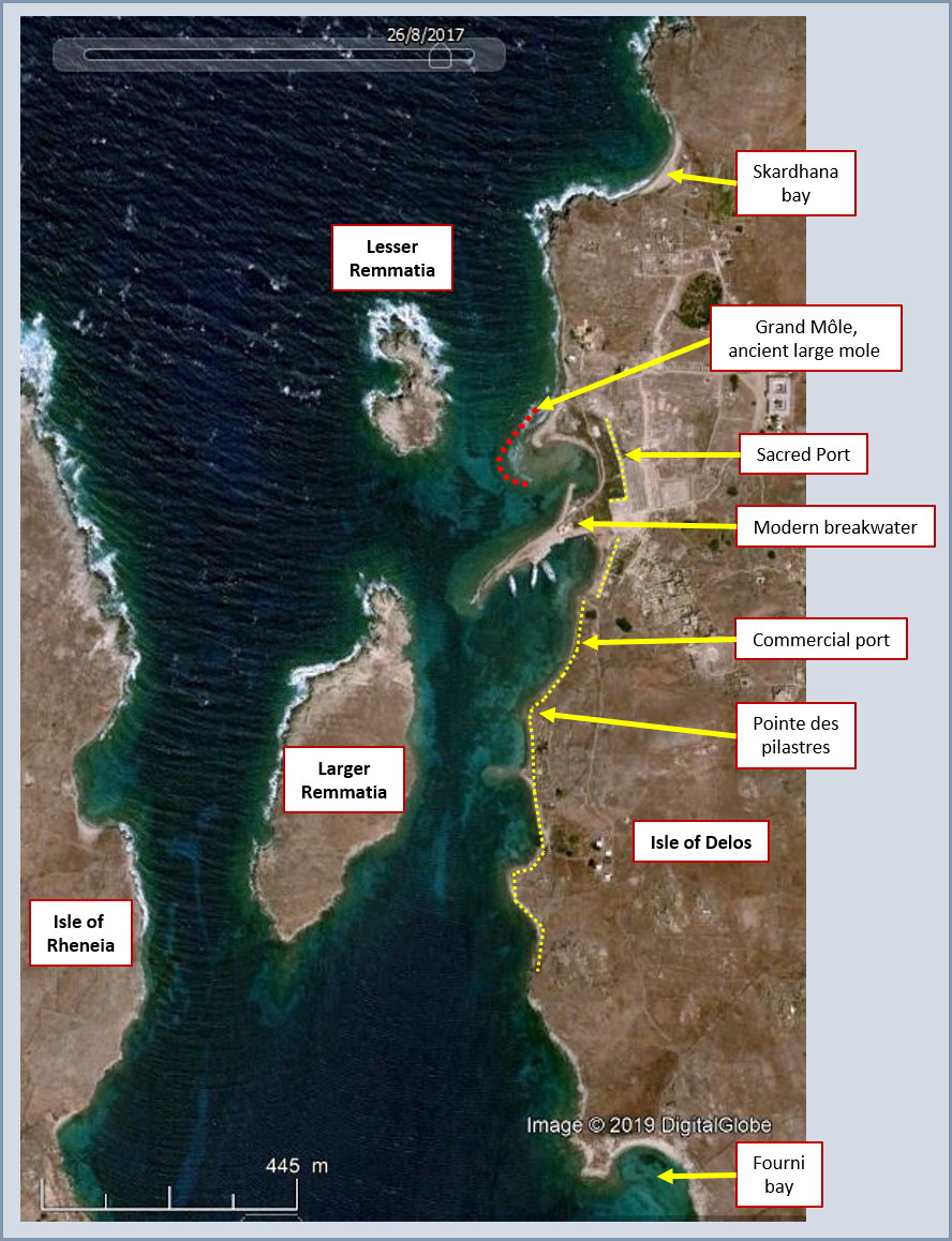
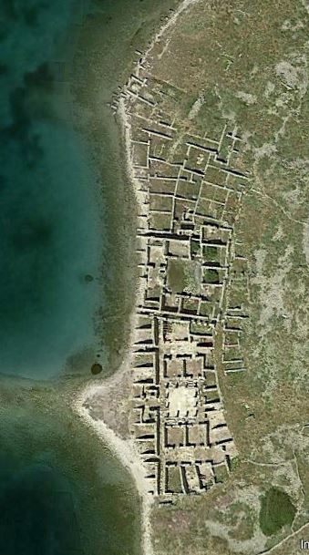
The mass grave on Rheneia was found on the eastern coast at a place called Fossa Katharsis, but the exact location of Polycrates’ chain is not known. The location of Nicias’ floating bridge can be guessed from beach to beach, via the isle of Remmatia (ancient Hecate insula). The Sacred Port is located just in front of the Apollo temple and is now silted-up but still visible, and the commercial quays are disseminated along the coastline south of the Sacred Port, down to the Pointe des pilastres, and even further south to the bay of Fourni where a natural shelter against northern winds (Meltem) is available. In addition, despite the limited shelter against northern waves, a potential quay was found on the east coast at Gourna.
Major archaeological excavations were conducted in the early 20th c. and most of the information available to us today comes from this period. However, these excavations have changed the ancient seascape so much that it became difficult to recognise the ancient port layout.
The latest archaeological source is from Hervé Duchêne and Philippe Fraisse (2001) and Kolaiti & Mourtzas (2023), and geomorphological work by Dalongeville (2007) shows that the ancient sea level was ca. 2.5 m lower than today.
Let’s start with a detailed chart of the Delos strait located between the Delos and Rhenia islands:
(https://gallica.bnf.fr/ark:/12148/btv1b53061904m )
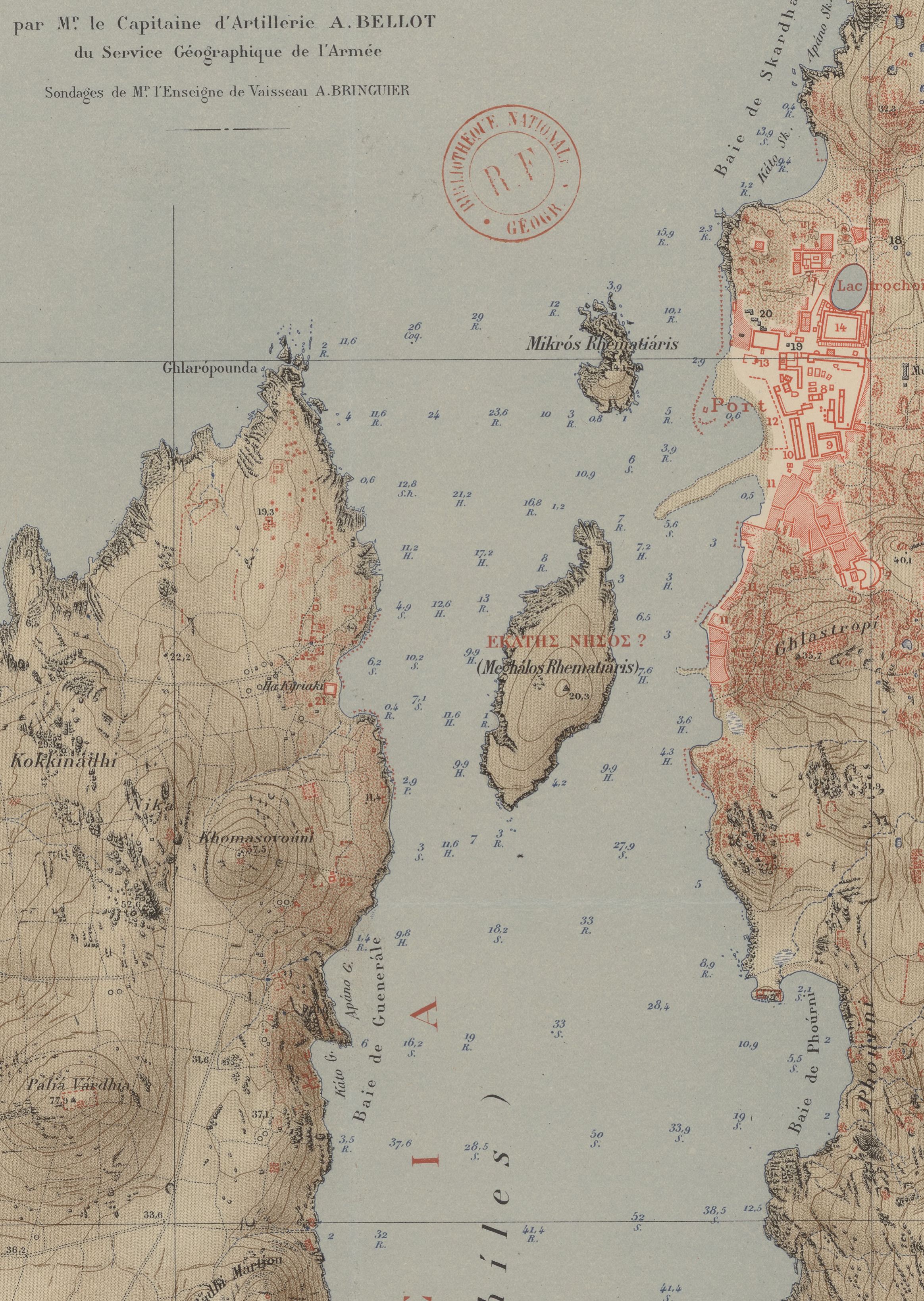
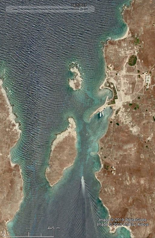
From north to south along the Delos coastline (right side of the chart):
- The distance between the curved “large mole” (located at the spot where “Port” is mentioned on the chart) and Lesser Remmatia (Mikros Rhematiaris on the chart) is around 150 m, with a water depth reaching 5 m (2.5 m in Antiquity) which almost closes the gap between the coast and the island, thus offering good shelter to the whole area located south of it.
- The narrow SW-oriented strip of land is made of rubble from archaeological excavations and is not ancient. It became the core of the modern breakwater.
- The water depth in the channel between Delos and Larger Remmatia (Meghalos Rhematiaris on the chart) is 6.5 to 7.6 m (4 to 5 m in Antiquity) allowing access to ancient ships coming from the north in this 100-150 m wide channel.
The northern wind (Meltem) in this area blows at more than 15 knots (Beaufort force 4) for ca. 40-50% of time in summer. A good shelter from this wind direction was obviously needed for safe anchorage near Delos and this was provided by Lesser Remmatia separated from the coastline by very shallow waters.
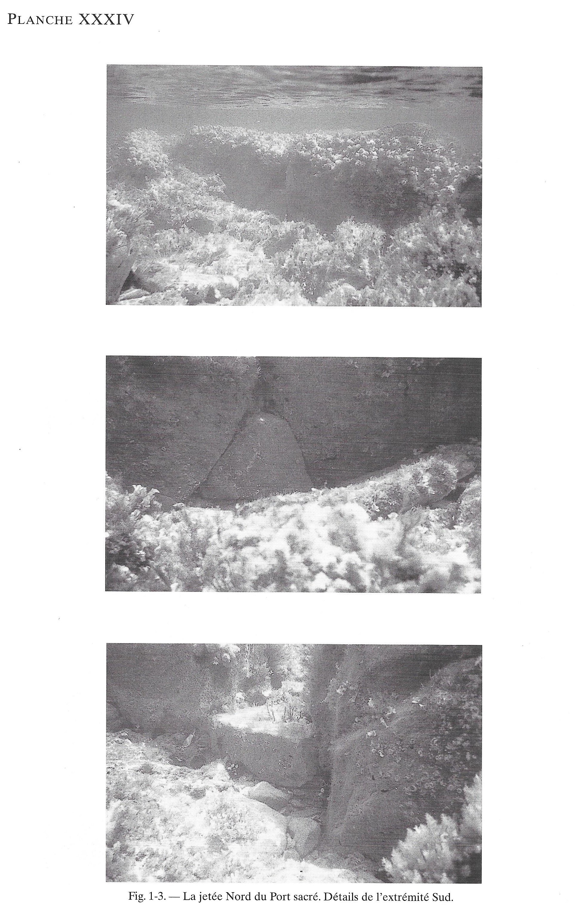
The Sacred Port
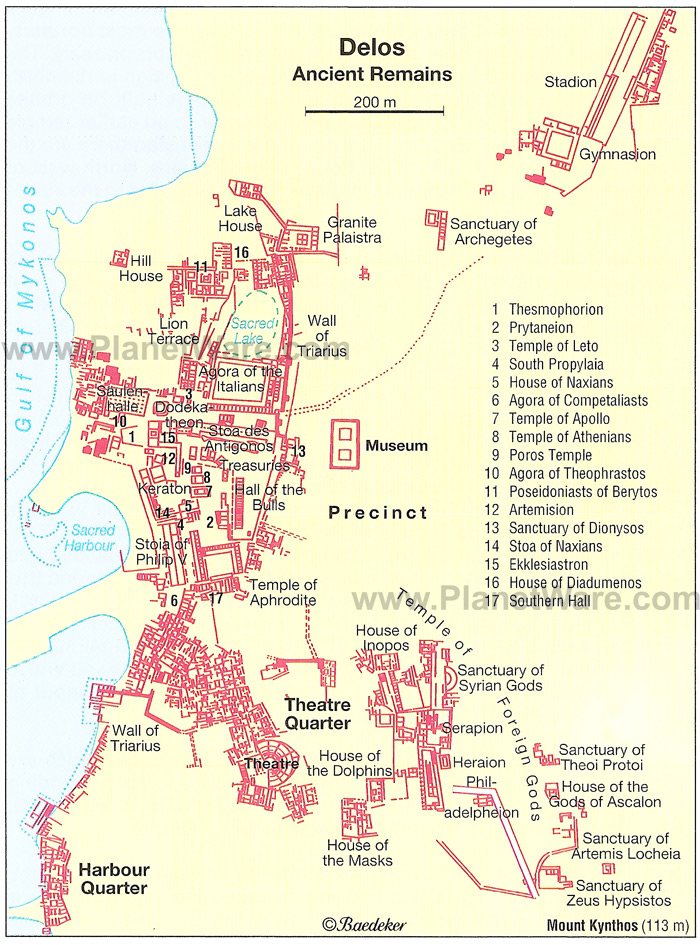
(https://www.planetware.com/greece/delos-gr-aeg-delos.htm)
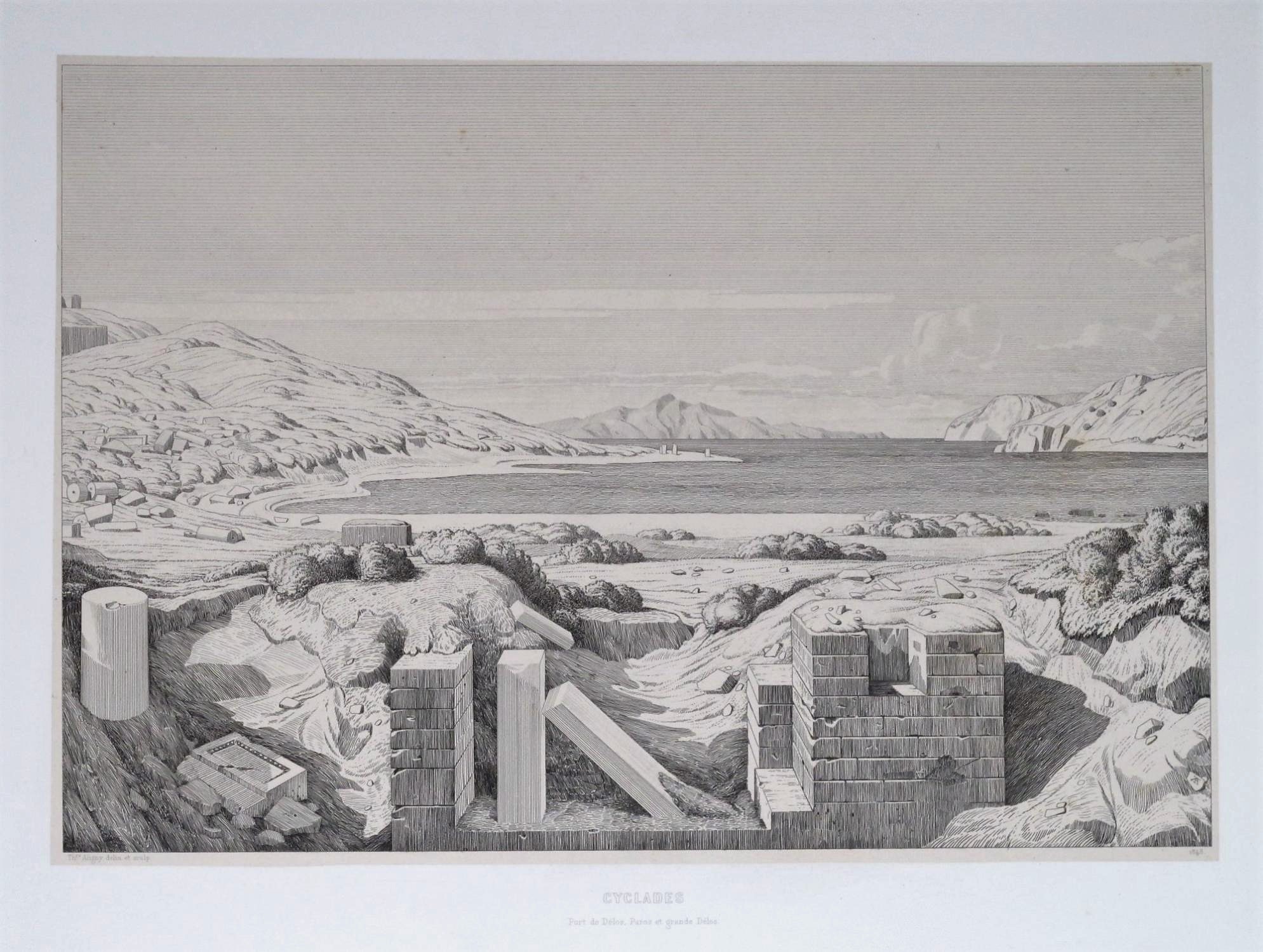
drawing by Théodore d’Aligny (1843-45)
showing the Sacred Port, looking south towards the Pointe des pilastres.
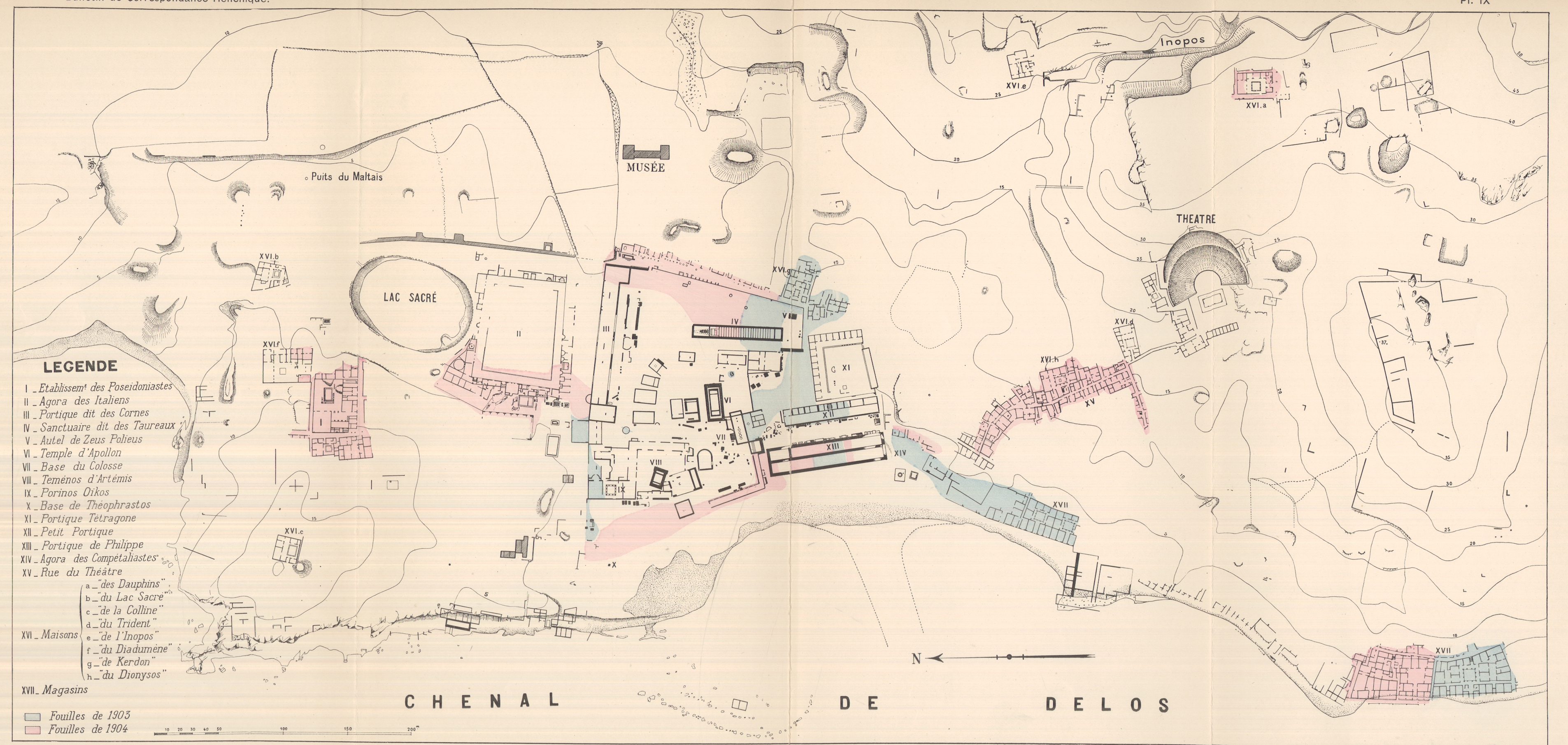
The picture above was made before any archaeological excavation took place and is therefore not showing the modern breakwater which would be located in the centre of the bay. The ancient large mole is located beyond the right side of the picture. The modern breakwaters just south of the Sacred Port and south of the Pointe des pilastres are the result of archaeological excavations which have dumped abundant rubble material into the sea at both of these locations, thus creating some protection of the coastline against northern wave attack, as shown on the map provided by Convert after Jardé’s excavations in 1903 and 1904.
According to Ardaillon (1896) the large mole consisted of an existing reef reinforced by stones placed on top of it, resulting in a kind of coastal protection running parallel to the shore.
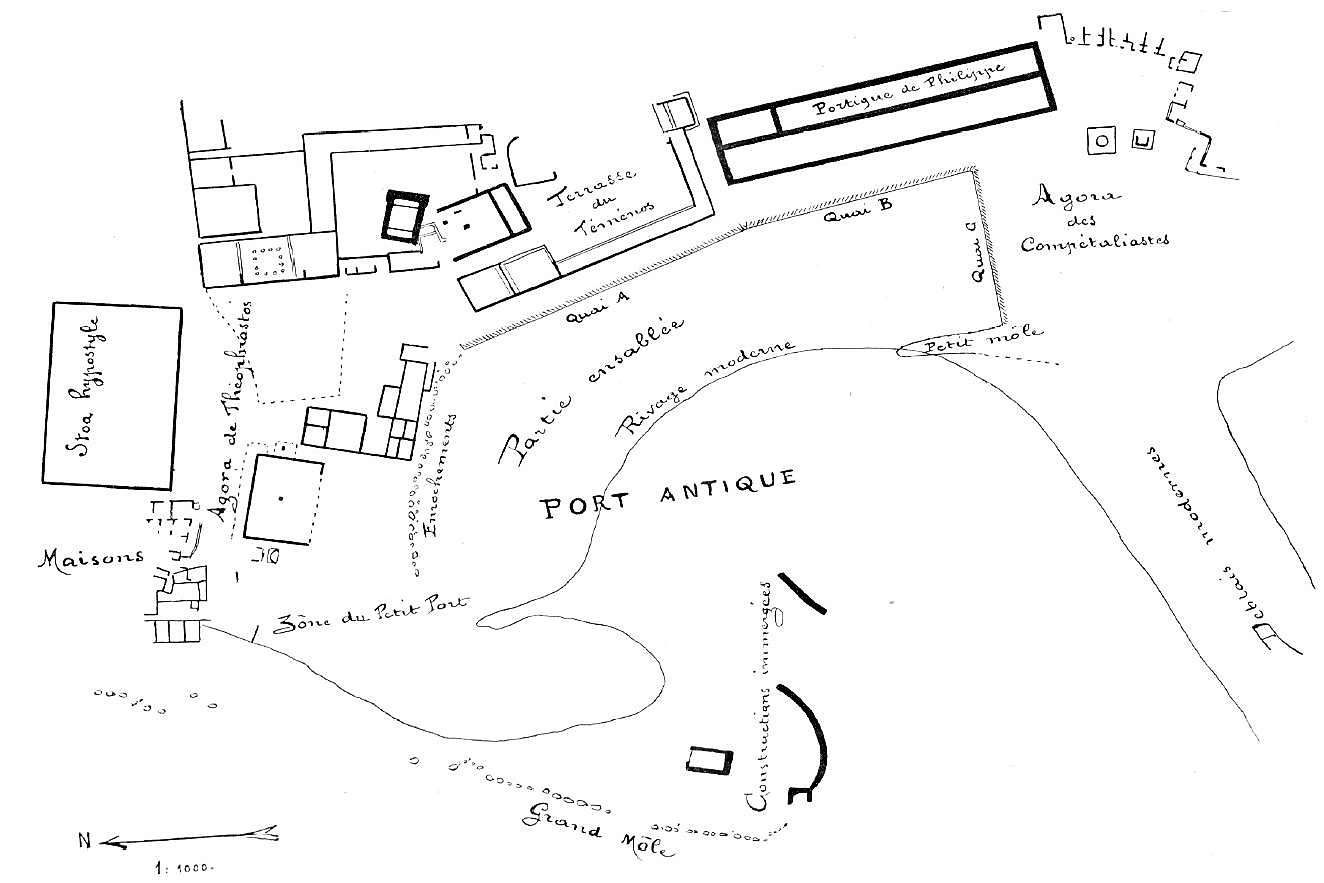
Holleaux (1909) produced the map below showing the large mole (“Grand Môle”) and three quays (A, B, C) assuming a traditional port layout with a breakwater protecting three quays. The area between his quays A and B and his coastline (“Rivage moderne”, which is fairly close to today’s coastline around one century later) was silted-up (“Partie ensablée”).
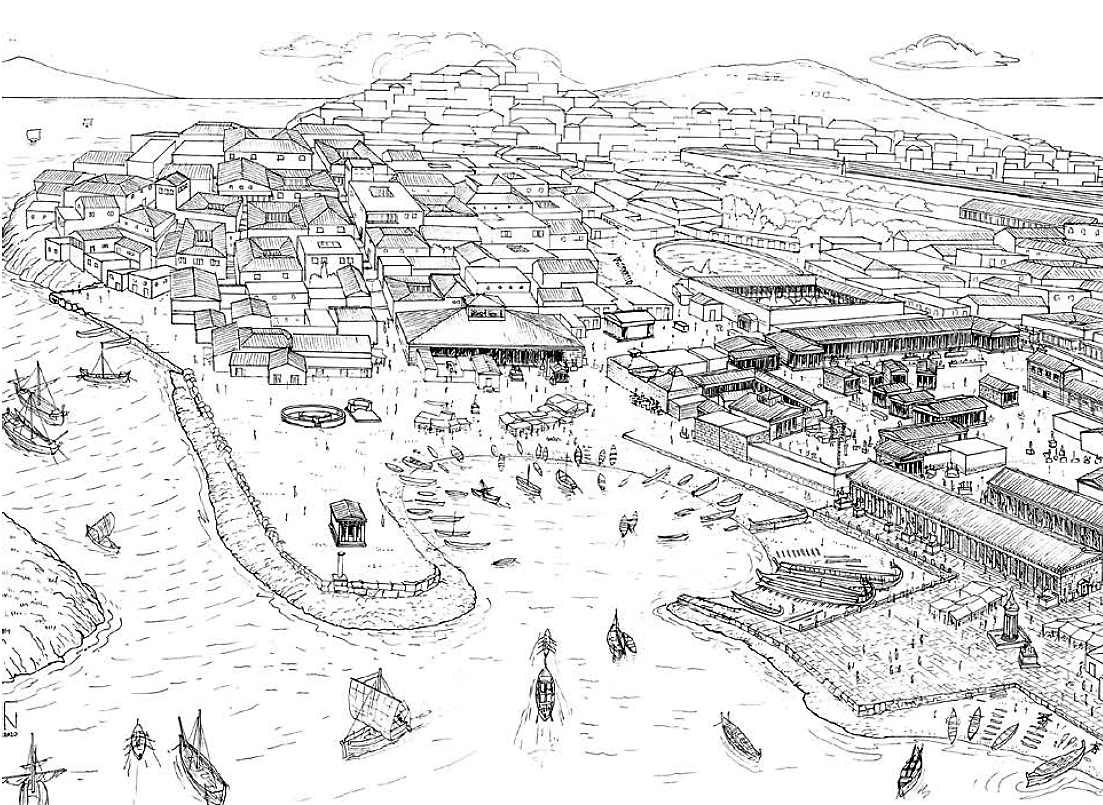
The Sacred Port was initially probably no more than a protected beach area, and a retaining wall was added in front of Apollo’s temple with a beach in front of it. The large mole would then just shelter a beach where only small ships would have access (Nakas, 2020 & 2022).
Sacred Port and a narrow beach (looking north).
Note this picture assumes a 2.2 m Sea Level Rise since Antiquity.
The excavation dump (“Déblais modernes” of Holleaux’s map) became the core of a modern breakwater structure with a quay on its southern side where today’s ferries bring tourists from Mykonos for day trips to Delos. It can be seen on the Google Earth picture below. This picture also shows a nice wave pattern due to a mild northern Meltem wind. Waves propagate mainly on the western side of both Remmatia islands and the Sacred Port is somewhat sheltered by the Lesser Remmatia islet (see detail picture below).
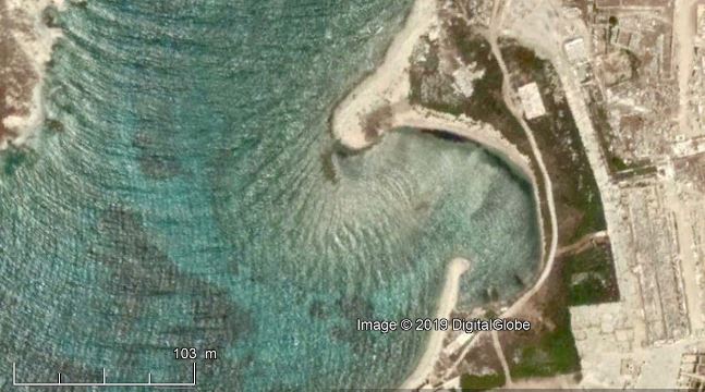
Lesser Remmatia islet and remains
of northern “large mole”.
See also wave diffraction pattern around the submerged remains of the large mole.
(Google Earth 24/7/2017)
The remains of the large mole were surveyed by Philippe Fraisse at the end of the 20th c.
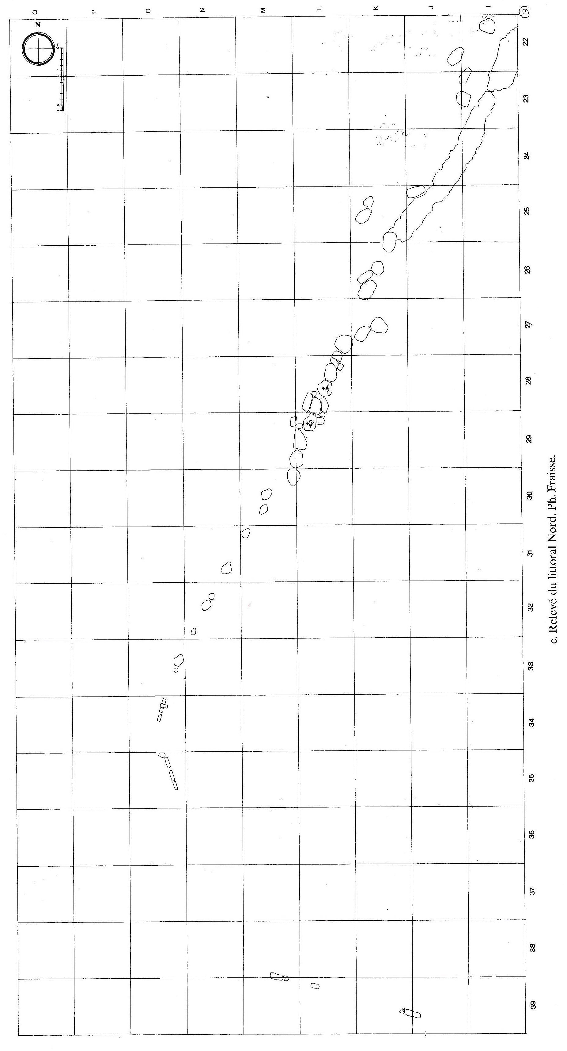
Scale: each square is 10 m, North is top.
placed in its natural context
(approximate location).
The large mole shown on this picture is around 200 m long, including the curve inside the port. This structure is continued for another 200 m to the north as a coastal protection.
Because of its structure with polygonal ashlar, this large mole might be as old as the first coastal structures, i.e., the 8th c. BC.
Unfortunately, even the more recent 14C dating of beachrocks similar to that found at the top of the large mole could not provide a more precise age than a range between 2000 BC and 130 BC (Mourtzas, 2024).
(Duchêne & Fraisse, 2001)
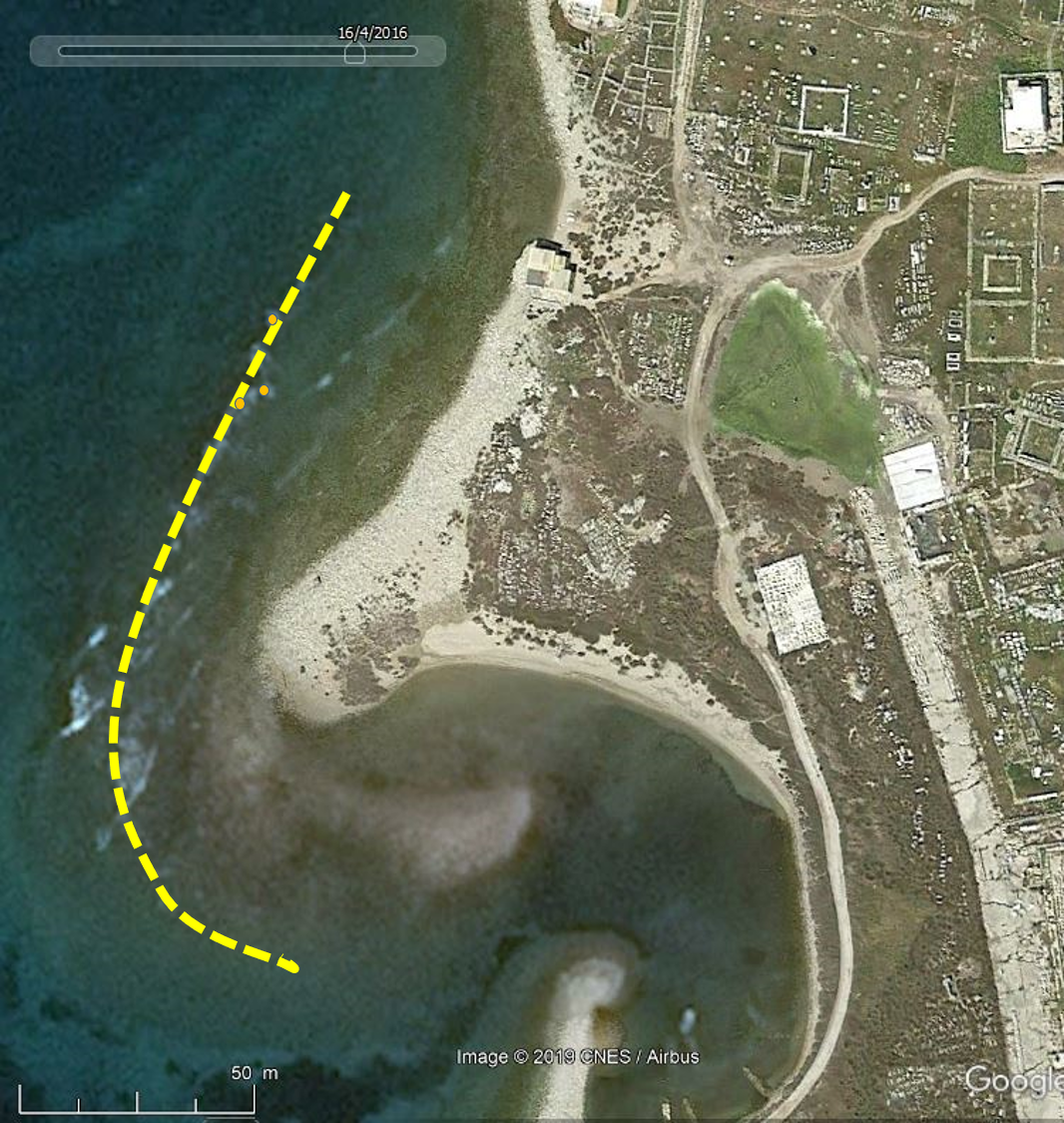
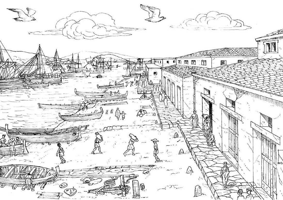
The Commercial Port
Although some erosion occurred and the sea level rose by ca. 2.5 m, the best-preserved port remains are found at the Pointe des pilastres and south of it.
an archaeological dump of excavation rubble)
The commercial port extends over around 800 m south of the Sacred Port. Shops and warehouses are aligned next to each other on the water side. They seem to have been literally on the water edge, with a narrow beach in front of them. However, the water depth in the narrow channel between Delos and Remmatia islands may have reached 4 to 5 m allowing uneasy access to large ships.
Note this picture assumes a 2.2 m Relative Sea Level Rise since Antiquity.
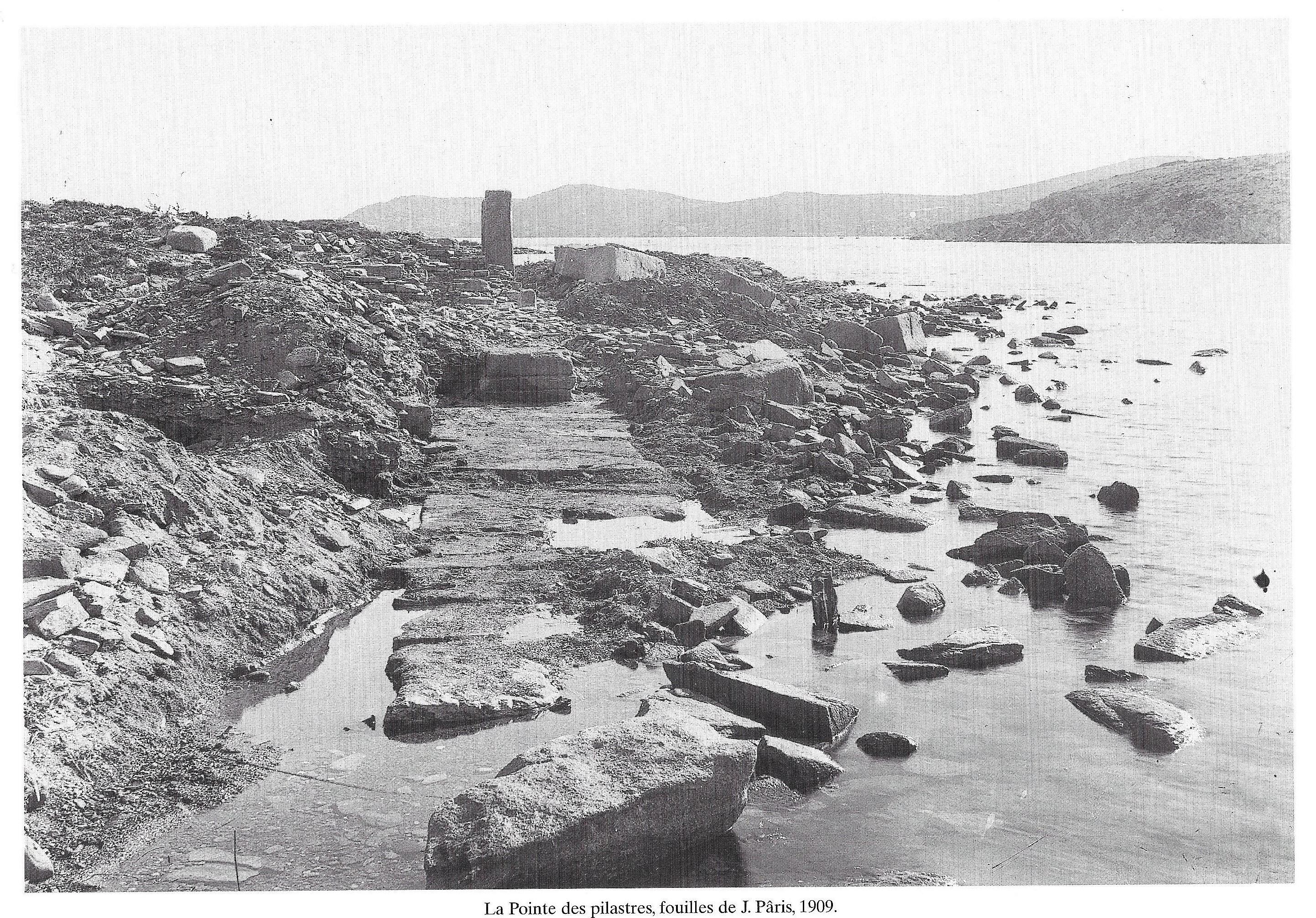
towards the remaining pilasters,
with the isle of Rhenia in the background.
It was noted by archaeologists that the warehouses were not as large as might be expected in a large commercial port (Duchêne, 2001; Hasenohr, 2023). It is therefore envisioned that business located at the Pointe des pilastres, was mainly for local consumption of Delian inhabitants. No significant transshipment was operated, and no large storage area was available on land (Nakas, 2020 & 2022). Delos would thus be seen as a place of transit were ships anchor in a fairly poor shelter between Delos and Remmatia islands, where cargo is negotiated without unloading the ships, and from where ships sail to new destinations.
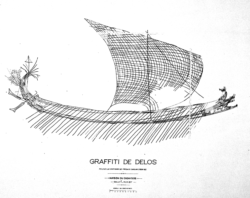
Carlini’s Graffiti reproductions
We cannot visit the isle of Delos without speeking about ancient ships. A few of the famous reproductions made by Capt. Carlini are shown hereunder. The real graffiti are available in the beautiful Delos Museum, but almost nothing is now left of them.
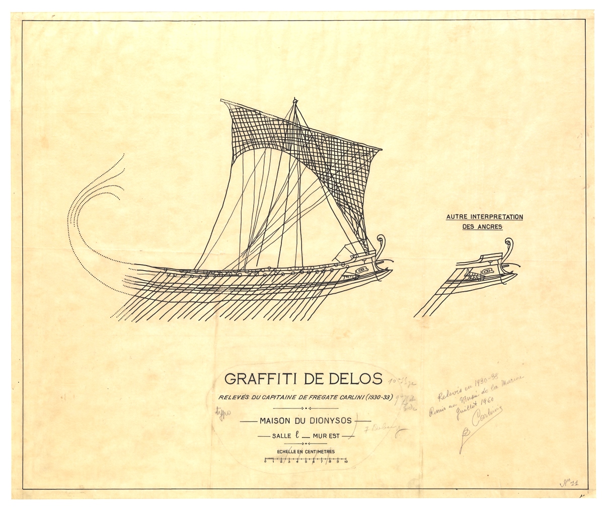
If each sketched oar represents 3 levels of one oarsman, then this ship is a trireme with 170 oarsmen
(Musée de la Marine, Paris).
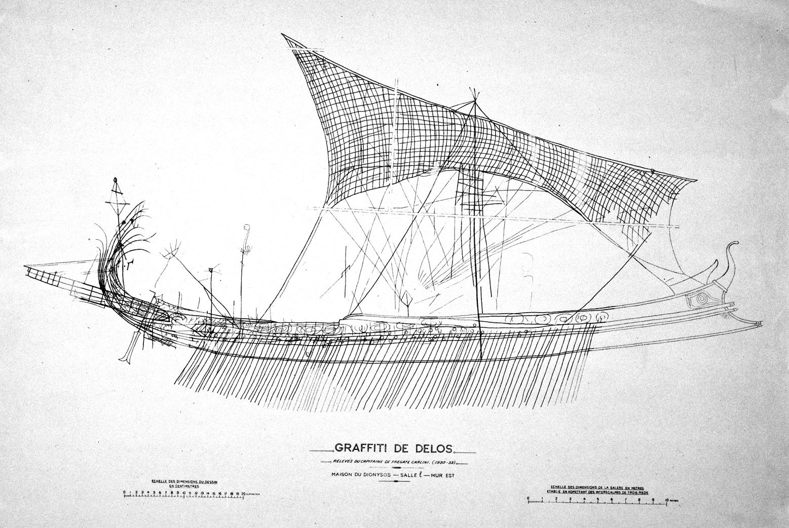
The graffito was over 1 m long and surely is one of the finest pictures of a trireme
(Musée de la Marine, Paris).
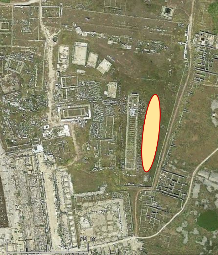
The Bull’s Monument
The Bull’s Monument takes its name from the statues of bulls, but has no further connection with these beasts. It was probably built around 330-320 BC by Athens and its dimensions are 69.4 x 10.4 m. It was a neorion hosting an ex-voto Athenian trireme of 35-40 x 5-6 m (Basch, 1989).
The east side of the Bull’s monument, features a vast open space without any ancient construction, and Lucien Basch believes that this is the location of the “Delos ship”, which was the flagship of the Macedonian king Antigonus II Gonatas in the naval battle off Cos against Ptolemy II Philadelphus of Egypt, around 250 BC. The largest warships in antiquity were built In this period.
This mega-ship, named “Isthmia”, may have had 18 oarsmen per side, on two levels of 9 oarsmen, i.e. 36 oarsmen on a transversal section. With 50 similar sections, a total of 1800 oarsmen would have been on board. The ship would then have to be around 70 m long and possibly 20 m wide.
Lucien Basch suggests the graffiti below might have represented this ship. This is pure conjecture, but fascinating!
The graffito was 85 cm long and if each sketched oar represents 2 levels of 9 oarsmen, then this ship had 1800 oarsmen.
(Musée de la Marine, Paris).
Some believe that Caligula made a replica of this ship (ca. 40 AD) which is known as the “Nemi I” because it was used for naval games on Lake Nemi, north of Rome. This ship (and a second one) were found buried in the mud on the bottom of the lake, they were recovered and studied in 1927-32, but unfortunately disappeared during a fire in 1944.
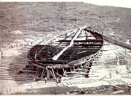
Ship size 73 x 24 m, note the size of the persons standing in front of the ship.
According to Lucien Basch, this ship would fit perfectly in the open area east side of the Bull’s monument …
near the neorion of the Bull’s Monument.
References
ARDAILLON, E., 1896, “Rapport sur les fouilles du port de Délos”, Bulletin de Correspondance Hellénique, N° 20, (p 428-445).
BASCH, L., 1989, “Le “navire invaincu à neuf rangées de rameurs” de Pausanias (1, 29.1) et le “monument des taureaux”, à Delos”, Tropis III, (p 43-72).
CONSTANTAKOPOULOU, C., 2017, “Aegean Interactions, Delos and its Networks in the Third Century”, Oxford University Press, (350 p).
CONVERT, H., 1906, Bulletin de Correspondance Hellénique, N° 30.
DALONGEVILLE, R., et al., 2007, “Hausse relative du niveau marin à Délos (Cyclades, Grèce) : rythme et effets sur les paysages littoraux de la ville hellénistique”, Méditerranée, 108 | 2007, http://mediterranee.revues.org/154 .
DUCHENE, H., and FRAISSE, P., 2001, “Le Paysage portuaire de la Délos antique”, Ecole Française d’Athènes, (192 p).
HASENOHR, C., 2012, “Ariarathès, épimélète de l’emporion et les magasins du Front de mer à Délos”, in: Tout vendre, tout acheter. Structures et équipements des marchés antiques., edt Ausonius, (p 245-260).
HASENOHR, C. et al., 2023, “Le port de Délos”, Entre Mares conference 2021, Urteaga edt, (p 615-624).
HOLLEAUX, M., 1909, “Rapport sur les travaux exécutés dans l’île de Délos par l’École française d’Athènes pendant l’année 1908”, in: Comptes rendus des séances de l’Académie des Inscriptions et Belles-Lettres, 53ᵉ année, N° 5, 1909, (p 397-417).
KOLAITI, E. & MOURTZAS, N., 2023, “Late Holocene relative sea-level changes and coastal landscape readings in the island group of Mykonos, Delos, and Rheneia (Cyclades, Greece)”, Med. Geosc. Rev., 5, (p 99–128).
MOURTZAS, N. & KOLAITI, E., 2024, “Past and Future Impacts of the Relative Sea Level Rise on the Seafront of Ancient Delos (Cyclades, Greece) and Flooding Scenarios by 2150”, J. Mar. Sci. Eng. 2024, 12, 870, (19 p).
NAKAS, I., 2020, “Ships and harbours of the Hellenistic and Roman Mediterranean: a new approach”, Honor Frost Foundation, Maritime Archaeology Graduate Symposium, 22-23 February 2020, Short Report Series, (25 p).
NAKAS, I., 2022, “The Hellenistic and Roman Harbours of Delos and Kenchreai”, BAR International Series 3099, Nautical Archaeology Society Monograph Subseries, Volume 6, (186 p).
PÂRIS, J., 1916 “Contribution a l’etude des ports antiques du mond Grec”, Bulletin de Correspondance Hellénique,N° 40, (p 5-73).
UCELLI, G., 1950, “Le Navi di Nemi”, Libreria dello Stato, Roma, (386 p).